Home > Historic Landscape Characterisation > Upland Ceredigion > |

Upland Ceredigion North-West Historic Landscape Characterisation

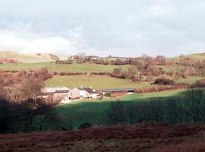
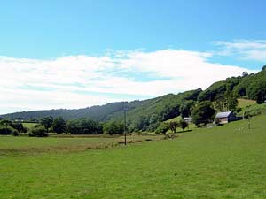
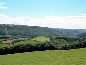
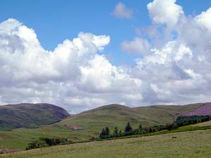
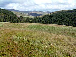
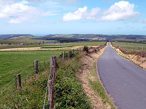
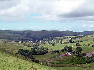
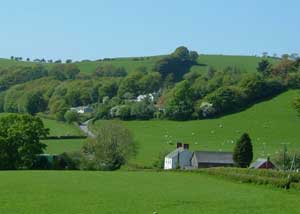
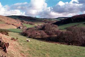
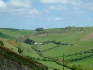
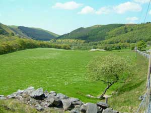
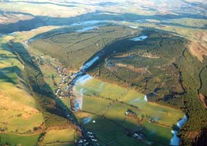
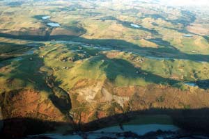
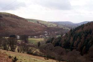
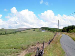
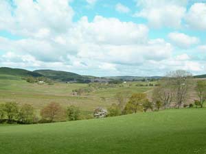
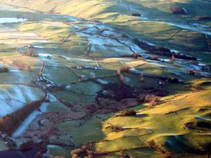
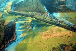
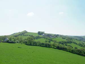
The listings below are summaries, for further information click on the photograph
Base maps reproduced from the OS map with the
permission of Ordnance Survey on behalf of The Controller of Her Majesty's
Stationery Office, © Crown Copyright 2001. All rights reserved. Unauthorised
reproduction infringes Crown Copyright and may ead to prosecution or civil
proceedings. Licence Number: GD272221
|
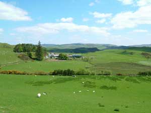
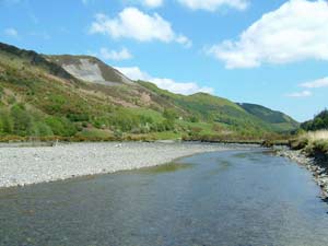
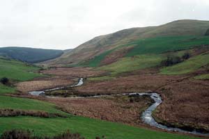
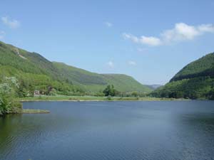
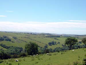
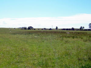
Afon Leri historic landscape character area consists of the valley floor and steep, lower valley sides of a small river. It is essentially an agricultural landscape of stone-built farms, and fields bounded by hedges and dry-stone walls, but includes the remains of 18th and 19th century metal mines. |
 |
|
A steep valley side covered with woodland is the main component of Allt Goch. There are no settlements, but the remains of metal mines can be found within the woodland. |
 |
|
Allt y Gwreiddyn is a steep heavily wooded valley side. There are a few open areas of pasture within the woods, but no settlements. |
 |
|
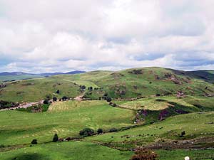
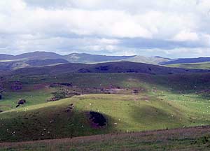
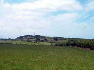
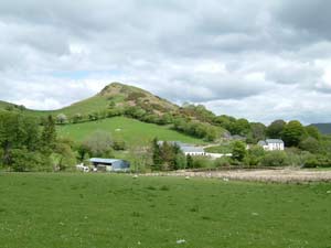
Banc Bwlch Roser is a ridge of mostly improved land lying between high, open moorland and lower-lying enclosed farmland. It contains two deserted farmsteads and the remains of metal mines. |
 |
|
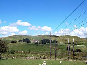
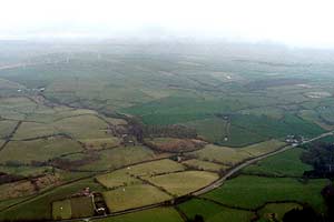
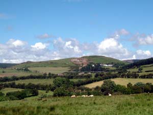
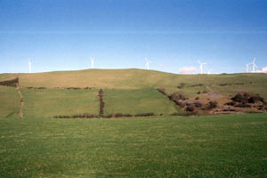
A high ridge of open moorland with a windfarm and the remains of 19th century lead mines characterise the Banc Bwa-Drain historic landscape character area. |
 |
|
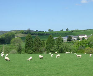
A regular field system of earth banks topped with hedges characterises the ridge of Banc Ceunant. It is sandwiched between lower lying farmland and higher moorland. There are no settlements. |
 |
|
Sandwiched between higher moorland and lower-lying enclosed farmland, the high ridge of Banc Lletty Ifan Hen comprises large fields of improved pasture divided by wire fences. There are no settlements, but the remains of old lead mines are prominent. |
 |
|
Open unenclosed moorland with pockets of improved grazing divided by wire fences characterise the Banc Llechwedd-Ddu historic landscape character area. There are no settlements. |
 |
|
Rough grazing with the remains of lead mining are the main characteristics of this small pocket of moorland know as Banc Trawsnant. It is now almost surrounded by coniferous plantations. |
 |
|
Banc Troedrhiwseiri consists of a ridge of improved pasture divided by earth banks and wire fences. There are no settlements. |
 |
|
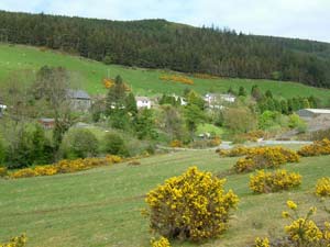
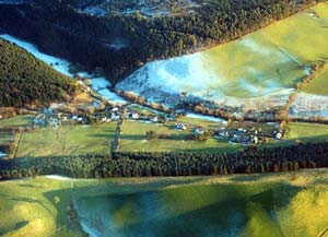
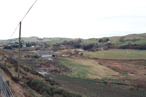
Bont-Goch is a complex landscape area comprising a loosely nucleated village of 19th and 20th century buildings, dispersed small farms, and large fields of improved pasture and rough grazing. The remains of the lead mining industry are prominent. |
 |
|
Bryngwyn is a landscape of dispersed farms and houses, set within small, irregular fields, with occasional stands of deciduous and coniferous woodland. Buildings are mainly 19th century or later 20th century in date. |
 |
|
Although the Bwlchcrwys landscape appears to consist chiefly of unenclosed improved pasture and dispersed farms, closer examination reveals wire fences and old boundary banks. It is a hilly landscape with few trees except for small coniferous plantations and those trees close to dwellings. |
 |
|
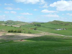
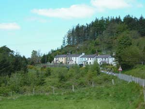
A 19th century industrial village lies at the centre of the Capel Bangor historic landscape character area. The buildings at the core of the village consist of small, worker cottages and houses, with larger late 19th century ‘villas’ on its outskirts. This industrial development overlies a landscape of fields bounded by hedges on banks and dispersed farms. |
 |
|
Cefn Bangor and Cefn Fuches historic landscape character area consists of dispersed farms and fields divided by earth banks. Some banks are topped with hedges, but wire fences are now the main boundary type. Farms buildings are mainly 19th century with a few modern dwellings. |
 |
|
Cnwch Coch originated as a squatter settlement in the late 18th century. This accounts for the number of small, vernacular cottages in the loosely clustered village. Surrounding the village is a landscape of small, irregular fields bounded by hedges on banks. |
 |
|
Dispersed farms, small, irregular fields and stands of deciduous and coniferous woodland on the floor and lower sides of the upland valley of the Afon Stewi characterise the Coed Gruffydd historic landscape character area. |
 |
|
A few dispersed small farms and fields of improved pasture bounded by banks and hedges within a narrow, steep-sided upland valley characterise the Cwm-Magor historic landscape character area. |
 |
|
Cwmerfyn is a complex landscape lying at the head of a steep-sided upland valley. Its main components comprise the remains of 18th and 19th century metal mining, worker cottages and dispersed farms. These are set in a landscape of irregular fields of improved pasture. |
 |
|
Farms dispersed along a steep-sided valley floor, small fields of improved pasture and the substantial remains of 19th century metal mines are the main components of the Cwmnewidion historic landscape. |
 |
|
The remains of the metal mining industry, dispersed 19th century worker houses, scattered farms and a 20th century hydro-electric scheme squeezed into the narrow valley floor and lower, steep valley sides of the Rheidol, characterise the Cwm Rheidol historic landscape character area. |
 |
|
The remains of 18th and 19th century metal mining lying across the floor and lower slopes of a steep-sided upland valley, dominate Cwmsymlog historic landscape area. Derelict industrial buildings, spoil tips, worker houses, other domestic buildings and a chapel all comprise important landscape elements. |
 |
|
Dispersed farms, and irregular fields bounded by earth and stony banks sometimes topped with hedges are the main components of the Cynnull historic landscape. |
 |
|
Dispersed farms, a small cluster of 19th century worker cottages, the remains of 18th and 19th century metal mining and fields of improved pasture characterise the Daren landscape. |
 |
|
The Ystwyth valley in the Grogwynion and Gwaithgoch historic landscape area is narrow and steep sided. The valley floor is unenclosed and used for rough, wet grazing. Two farmsteads lie on lower slopes, but it is the remains of 19th and 20th century metal mines that dominate this area. |
 |
|
A regular field system of improved pasture divided by banks with hedges, and deciduous and coniferous plantations are the main components of the Hen Gaer landscape. There are no settlements. Of importance is the Iron Age fort from which the area gets its name. |
 |
|
A small linear village of 19th, 20th and 21st century houses lies at the centre of the Llanafan historic landscape character area. Small fields of pasture surround the village. |
 |
|
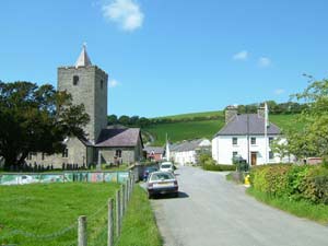
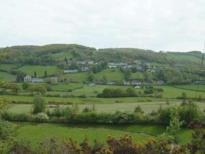
The village of Llanfihangel-y-Creuddyn lies at the heart of this historic landscape character area. It is a small, nucleated village with a Medieval church at its heart and, unusually for the region, several houses pre-dating the 19th century. The village is surrounded by farmland and dispersed farms. |
 |
|
Lying across the floor and lower slopes of an upland valley, Llawr-y-Cwm-Bach consists of several deserted settlements, an upland farm, the remains of metal mining and rough pasture with pockets of improved pasture. |
 |
|
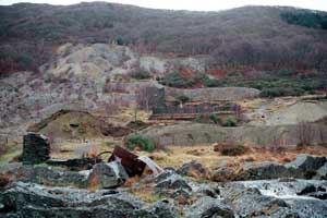
Lletty Synod and Frongoch consists of a hilly landscape, between 220m and 340m, of dispersed farms and the remains of the metal mining industry. These industrial remains are a strong component of the historic landscape and at Frongoch they include probably the best collection of 19th century mine buildings in Wales. |
 |
|
Llwyn-Crychyddod is a small historic landscape area comprised entirely of regular fields established in the late 18th and early 19th centuries. There are no settlements. |
 |
|
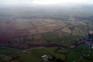
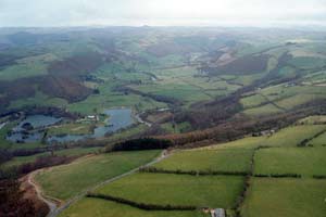
Dispersed farms and small, irregular fields of improved pasture on the flat floor and lower slopes of the Rheidol characterise the Lower Rheidol Valley historic landscape character area. Also present are lakes in old gravel workings and the small remains of metal mining. |
 |
|
Maen Arthur is essentially an agricultural landscape of dispersed farms and small irregular fields of pasture. The remains of small 19th century metal mines are located in this area, as is New Row, a line of worker cottages. |
 |
|
A couple of upland farms and abandoned cottages/smallholdings lying within small fields of pasture characterise the Moelgolomen landscape. There are traces of 19th century metal mining in this area. |
 |
|
Extensive 20th century coniferous plantations are the main component of the Mynydd March landscape. They were planted over open moorland where the remains of several deserted cottages, old metal mines, an Iron Age fort and Bronze Age standing stones have been identified. |
 |
|
Nantyrarian historic landscape character area comprises an agricultural landscape of dispersed farms and small fields spread across the floor and lower valley sides of a steep-sided valley, over which are superimposed 18th and 19th metal mines and mining communities. The mining settlements are prominent components of the landscape. |
 |
|
Twentieth century coniferous plantations define and characterise the Pant-y-Haidd historic landscape character area. The plantations were established over open and semi-open moorland. An Iron Age hillfort lies within the plantations. |
 |
|
Cottages/smallholdings in a landscape of improved pasture and rough grazing, located on a ridge high above the Ystwyth valley, are some of the main components of the Pengrogwynion and Brynafan historic landscape. The settlement pattern originated as squatter settlements in the late 18th and early 19th centuries. |
 |
|
Penrhyn-coch is a complex historic landscape character area. The underlying pattern of old, dispersed farms set in small fields divided by banks with hedges is overlain by two 18th and 19th century industrial settlements - Penrhyn-coch and Pen-bont Rhydybeddau – and by extensive modern housing at Penrhyn-coch. |
 |
|
Pen-rhiw-newydd historic landscape character area lies on a rounded ridge of improved pasture that has been divided into fields by earth banks and occasional dry-stone walls. Two small 19th century hamlets - Pen-rhiw-newydd and Salem – lie on the ridge. |
 |
|
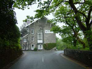
Centred on the famous Devil’s Bridge and the adjacent imposing Hafod Arms Hotel, Pontarfynach is essentially a village developed in the 19th and 20th century to serve the tourist industry. |
 |
|
Extensive stands of old deciduous woodland with some 20th century coniferous plantations on steep valley sides provide the main components of the Rheidol Valley Woodland historic landscape character area. Remains of the lead mining industry lie within the woodland. |
 |
|
Small fields defined by hedges on earth banks, dispersed farms and stands of deciduous woodland are the main components of the Rhosgoch historic landscape. |
 |
|
Rhos Rhydd is a ridge of improved pasture lightly enclosed by wire fences. There are no settlements, although a little woodland is present on some of the ridge’s flanks. An Iron Age hillfort lies within this historic landscape character area. |
 |
|
Prior to colonisation by squatter settlers in the late 18th and early 19th century Rhos-y-Gell was open moorland. Many of the numerous cottages and smallholdings that were established still survive, but some have been abandoned. They lie in a landscape of rough grazing. |
 |
|
Smallholdings and cottages within a landscape of improved pasture divided by earth banks with occasional hedges characterise the Rhydpererinion historic landscape. |
 |
|
Improved pasture divided by wire fences on a rounded hill characterise the Tal y Fan landscape. There are no settlements but two Iron Age hillforts are important landscape components. Deciduous woodland and coniferous plantations lie on the hill’s flanks. |
 |
|
Tanyffordd is essentially an agricultural landscape of small fields and dispersed farms, but includes the linear 19th and 20th century hamlet of Pisgah. |
 |
|
Regular fields of pasture divided by banks with hedges are one of the main components of The Hill. There is a small linear settlement here, which may have originated as a squatter settlement, and consists of 19th century cottages and modern houses. |
 |
|
Trawscoed is an estate landscape; at its core lies Trawscoed mansion, gardens and parkland. During the 20th century government institutions modified much of the parkland (although its essential character remains), and offices and large agricultural buildings have been constructed as well as some modern houses. |
 |
|
Small fields of pasture divided by banks with hedges, a little deciduous woodland, and dispersed farms and cottages are some of the main components of the Ty’n-y-Castell historic landscape character area. |
 |
|
Waun Wyddyl is an open hill of improved pasture divided by wire fences on which a wind farm was constructed in the late 20th century. An Iron Age hillfort and several possible Bronze Age funerary and ritual monuments provide time-depth to the landscape. |
 |
|
Many of the buildings in the Wenallt landscape are estate built or estate influenced, and include the Georgian house and farm of Wenallt built for the Trawscoed estate. The agricultural landscape is one of improved pasture fields divided by banks with hedges. Woodland and planted trees provide a parkland feel to parts of the landscape. |
 |
|
Ysgubornewydd landscape area lies on rounded hills and consists of fields of improved pasture divided by banks with hedges. There are no inhabited settlements, but an Iron Age fort and a Bronze Age round barrow provide time-depth to the landscape. |
 |
|
Ystumtuen is a complex historic landscape character area with the remains of the lead mining industry intermixed with agricultural holdings. The settlement pattern is fairly dense for a rural area, but numerous deserted house sites are testimony to a much more settled landscape in the 19th century. |
 |
Project contact: Ken Murphy