Home > Historic Landscape Characterisation > Upland Ceredigion > |

 RHEIDOL VALLEY WOODLAND
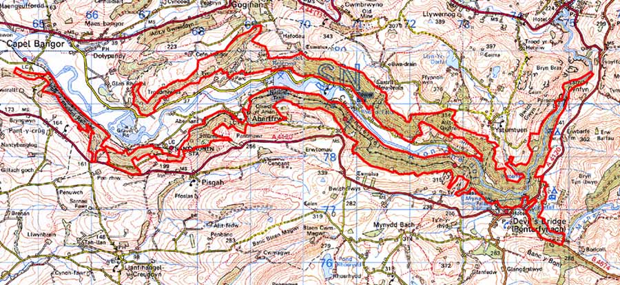
GRID REFERENCE: SN 744783
AREA IN HECTARES: 712.2
Historic Background
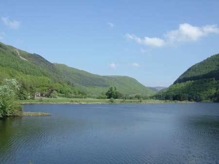
This area on the steep valley sides of the Rheidol represents the only block of ancient woodland in north Ceredigion. As with so many landscape areas of Ceredigion its early history has not been researched. By the 18th century almost all of the area had come into the possession of the Nanteos estate, and was divided amongst several farms, with some holdings belonging to the Crosswood estate. The first large-scale maps of the woodland are estate maps of 1819 (NLW Vol 45, 16-19, 22, 27-28, 30, 35). These show that the broadleaf woodland covered an almost identical area to that of today. The tithe survey demonstrates that this did not change during the 19th century. Set close to or in the woodlands are the remains of a lead mining industry. Mining is reputed to be of some antiquity in the valley (Prichard 1985, 6), although the main period of activity was the 19th century. Clearly the co-existence of large stands of woodland and lead mining - an industry that consumed large quantities of timber for a variety of purposes - indicates that the woodland was carefully managed. It must therefore have been under the control of the large estates and not of individual tenant farmers. Certainly Crosswood was carefully managing its woodlands from the early 18th century (Edlin 1959, 19). This is a topic that further research would elucidate. In the 20th century, conifer plantations have filled in open areas on the valley sides. Most of the remains of the lead mining industry have been assigned to the valley floor of the Cwm Rheidol historic landscape character area, and are included in its description, though shafts and spoil heaps lie in the woodland as does the Rheidol valley railway built to serve the mines in 1902. Temple, an important mine, lies wholly in this area. It was worked from 1876 to 1881.
Description and essential historic landscape components
This area comprises the steep north and south valley sides of the Rheidol, which rise from 50m on the valley floor to over 300m. The steepest slopes are those closest to Devil’s Bridge. Though mostly ancient broadleaf woodland, there are plantations of conifers and just a few pockets of open pasture and rough grazing. There are some boundary banks in the open areas; it is not known whether there are subdivisions within the woodland. The tips, shafts and levels of a lead mining industry lie within the woodland, but it is at Parson’s Bridge at the extreme northern end of the area that the more substantial and various mining remains of Temple mine can be found. Here there are dressing floors, remains of buildings and a massive wheel-pit (Bick 1983, 27). The Vale of Rheidol Railway, open in 1902 to serve the mining industry, runs along the southern valley side and now functions as a tourist line, conveying people from Aberystwyth to Devil’s Bridge.
The recorded archaeology of the area is almost entirely confined to remains of the metal mining industry. These are numerous and varied. Otherwise the only other major archaeological site is Tan-y-ffordd Iron Age hillfort.
This area of woodland is defined by farmland either on the floor of the Rheidol valley or on the surrounding hills.
Base map reproduced from the OS map with the permission
of Ordnance Survey on behalf of The Controller of Her Majesty's Stationery
Office, © Crown Copyright 2001.
All rights reserved. Unauthorised reproduction infringes Crown Copyright
and may lead to prosecution or civil proceedings. Licence Number: GD272221