Home > Historic Landscape Characterisation > Upland Ceredigion > |

 CEFN BANGOR & CEFN FUCHES
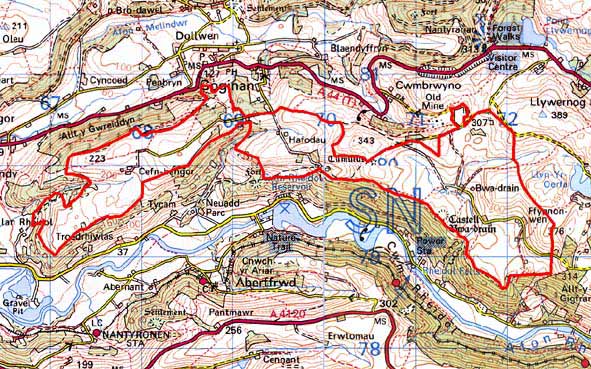
GRID REFERENCE: SN 714797
AREA IN HECTARES: 404.3
Historic Background
The history of this area has not been researched and is entirely unknown. During the Medieval period it does not appear to form part of one of the extensive granges of Strata Florida or Cwm-hir. In more recent times, unlike holdings in neighbouring areas, this area does not seem to have been incorporated into one of the great estates such as Gogerddan, Crosswood or Nanteos, and their estate maps make no reference to it. The first cartographic record is therefore the 1845 tithe map of Llanbadarnfawr parish. This shows a landscape of scattered farms and small- to medium-sized enclosures with larger fields bordering on higher ground at the eastern end. The farms and fields may be quite ancient, though the place-names Hafodau and Banc Hafodau may refer to transhumance settlements of Medieval or later date, which were later translated into permanent farmsteads. There have been few major changes in the settlement pattern and field system in the past one and a half centuries. A lead mine, Bwadrain, powered by a water wheel located in the valley of the Rheidol 240m lower down, operated from 1838, but had closed by the end of the 19th century (Bick 1983, 21).
Description and essential historic landscape components
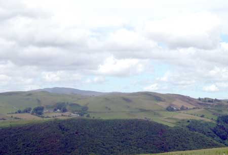
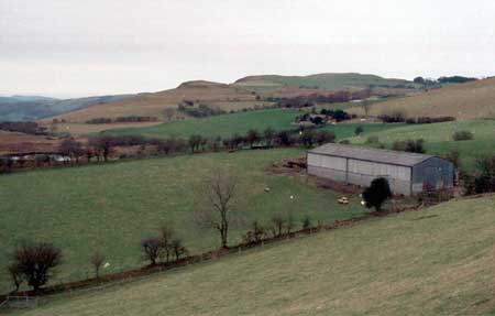
This area is essentially a high terrace fading into a lower ridge at its western end situated between 150m and 320m, with to the south the Rheidol valley and, to the north at the eastern end, higher unenclosed land. Given its well-settled nature, this is a relatively remote area, with access only from the valley to the north or through Ystumtuen to the east. Most of the land is under improved pasture, but there are rushy and peaty hollows, and rougher grazing on some steep slopes and high points. The area has been divided into enclosures by earth banks. Hedges are only present on these banks close to some of the farmsteads, and these, apart from those close to Cefn Bangor where some hedges are well maintained, are overgrown and becoming derelict. There are some distinctive hedgerow trees (beech) at lower levels close to farms, deciduous woodland on the ridge crest and scrubby woodland close to Hafodau. Wire fences on the old earth banks provide stock-proof barriers. Lack of hedges and trees at the eastern end of the area lends an open, unenclosed feel to the landscape, an impression that is less prevalent elsewhere.
The settlement pattern is of dispersed farms. Many of the farmhouses have been either substantially modernised or rebuilt, and there are a few other modern dwellings present. At least one 19th century farmhouse is present; these is of two-storeys and in the typical regional Georgian vernacular style, although in this instance Georgian traits dominate. Farms have one or two ranges of 19th century local stone outbuildings. Working farms have modern agricultural buildings, but these are not dominant components of the landscape. Deserted farms and cottages are in evidence.
Recorded archaeology in this area consists of metal mines and extant post-Medieval settlements. Neolithic finds from two separate locations and two Bronze Age round barrows provide time-depth to the landscape.
This is a well-defined area. To the south is the steep, heavily wooded valley side of the Rheidol, and to the north and northwest the steep, heavily wooded valley side of the Melindwr. To the northeast lies high, unenclosed moorland.
Base map reproduced from the OS map with the permission
of Ordnance Survey on behalf of The Controller of Her Majesty's Stationery
Office, © Crown Copyright 2001.
All rights reserved. Unauthorised reproduction infringes Crown Copyright
and may lead to prosecution or civil proceedings. Licence Number: GD272221