Home > Historic Landscape Characterisation > Upland Ceredigion > |

 RHOS RHYDD
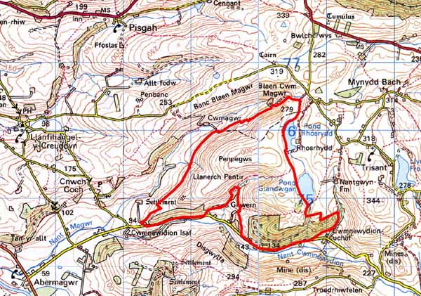
GRID REFERENCE: SN 697753
AREA IN HECTARES: 281.3
Historic Background
The early history of this small block of upland pasture has not been researched, but by the 18th century it was divided between the Crosswood and Nanteos estates. Late 18th and early 19th century estate maps (NLW Crosswood Deeds No.5, Ser IV, Vol 1, 16; NLW Vol 45, 41 and 42; NLW Nanteos 348 and 349) show this area as unenclosed sheep-walk with isolated, minor enclosures at its fringes. By the tithe survey of 1847 (Llanfihangel-y-Creuddyn parish) the area had been sub-divided into a few very large enclosures, but aerial photographs of the 1940s record it as having reverted back to unenclosed sheep-walk.
Description and essential historic landscape components
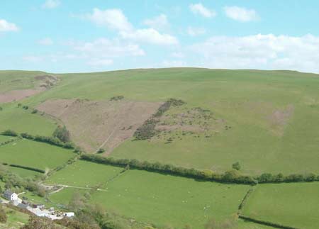
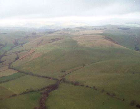
This landscape area is located at the western end of a rounded ridge that achieves a maximum height of 310m. To the west, north and south the land falls away steeply down to c. 100m, into the valleys of the Newidion and Magwr. Included in this area is the ridge crest and sides. There are no occupied settlements. Most of the land is now improved grazing, though pockets of rough pasture and patches of bracken are present on steep slopes. Wire fences now divide the area. Some of these fences follow the lines of old, low earth banks - these can be equated with those recorded on the tithe map - though others are on new lines. Medium-sized conifer plantations have been established on steep south-facing slopes, and these are interspersed with stands of old established hardwoods.
The recorded archaeology includes the major site of Castell Gareg-wen Iron Age hillfort, and a small earthwork enclosure of unknown date. Other sites are minor: a sheepfold and cultivation ridges; the latter indicating arable farming across this area in the Medieval or post-Medieval period.
To the north, west and south this area is well defined by enclosed and settled valley land. To the east definition is less obvious, and this area tends to merge with its neighbour.
Base map reproduced from the OS map with the permission
of Ordnance Survey on behalf of The Controller of Her Majesty's Stationery
Office, © Crown Copyright 2001.
All rights reserved. Unauthorised reproduction infringes Crown Copyright
and may lead to prosecution or civil proceedings. Licence Number: GD272221