Home > Historic Landscape Characterisation > Upland Ceredigion > |

 BANC TROEDRHIWSEIRI
GRID REFERENCE: SN670854
AREA IN HECTARES: 253.1
Historic Background
In the Medieval Period this area lay within Strata Florida Abbey’s Y Dywarchen Grange (Williams 1990, 57), where it probably served as upland pasture. In post-Medieval times the land passed into the possession of the Gogerddan and Crosswood estates. Late 18th century estate maps (NLW Gogerddan 67; Crosswood 345-6; Vol 38, 10, 12, 14) show the area as completely unenclosed except for two cottages or farms each with one or two paddocks close to the dwellings. By the 1840s the whole area had been divided into a system of medium- to large-sized, regular fields. Within this area lies Court Grange metal mine. The mine had been worked since 1695, but as with most mines in Ceredigion it was the 19th century that witnessed the main period of working. It closed in the last decade of the 19th century (Bick 1988, 28-31)
Description and essential historic landscape components
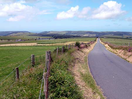
This is a rounded, east west aligned ridge that achieves its maximum elevation of 255m at its eastern end. Its flanks to the north and south run down to 130m-150m. Virtually the whole area is improved grazing, but there are hollows of peaty and rushy ground, and rougher land of bracken and gorse on the steeper slopes. The area has been divided into a series of very large enclosures by earth and stony banks, but these are now mostly redundant and wire fences form the stock-proof boundaries. Very occasional derelict hedges occur on some boundary banks, but this is essentially a treeless landscape apart from small stands of deciduous and conifer trees on the northern flanks. There are no inhabited settlements in the area. Remains of the lead mining industry include tips, a wheel pit, shafts, a reservoir and leats.
Other than the remains of the metal mining industry, Bronze Age monuments form the greater part of the archaeological record. Two standing stones and a possible third stone lie within the area, as do a ring barrow and a burnt mound or hearth - possibly indicative of a settlement site.
To the north and south this area is well defined by lower-lying enclosed land. To the east and west there is no clear boundary definition between this area and its neighbours.
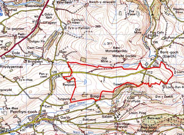
Base map reproduced from the OS map with the permission
of Ordnance Survey on behalf of The Controller of Her Majesty's Stationery
Office, © Crown Copyright 2001.
All rights reserved. Unauthorised reproduction infringes Crown Copyright
and may lead to prosecution or civil proceedings. Licence Number: GD272221