Home > Historic Landscape Characterisation > Upland Ceredigion > |

 ALLT Y GWREIDDYN
GRID REFERENCE: SN 680803
AREA IN HECTARES: 144.0
Historic Background
Although historically part of this area lies within Cwm-hir Abbey’s Nantyrarian Grange, it is likely that the very steep slopes on which it is located have always determined its use as woodland. It is shown wooded on the earliest maps of the area of 1790 (NLW Vol 37, 57, 60). The extent of woodland in 1790 is similar to that of today. Historic maps show it has not altered significantly during the last two centuries, although the Forestry Commission has replanted some stands of broadleaf woodland with conifers. By the 18th century much of this woodland lay within the Gogerddan estate. Careful estate management has been instrumental in preserving it from the ravages of the lead mining industry, and from tenant farmers and other individuals.
Description and essential historic landscape components
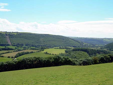
This is a steep-sided, north-facing, heavily wooded valley side ranging in height from 60m to 300m. The woodland is a mixture of broadleaves and conifers. Small open areas are present in this area. These comprise rough grazing and bracken covered slopes divided into fields. The few boundaries that exist consist of earth banks topped by wire fences. There is evidence of former stone quarrying in the woodland.
The borders of this area are well defined. To the north lies lower-lying enclosed land, and to the south either high enclosed land or unenclosed moorland.
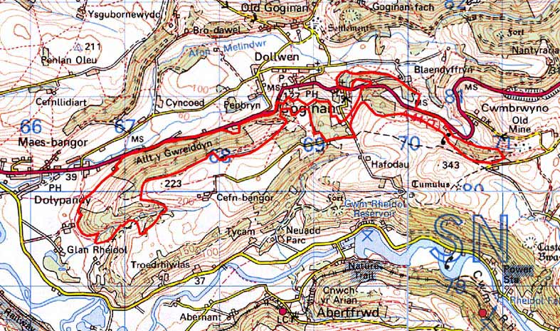
Base map reproduced from the OS map with the permission
of Ordnance Survey on behalf of The Controller of Her Majesty's Stationery
Office, © Crown Copyright 2001.
All rights reserved. Unauthorised reproduction infringes Crown Copyright
and may lead to prosecution or civil proceedings. Licence Number: GD272221