Home > Historic Landscape Characterisation > Upland Ceredigion > |

 BANC CEUNANT
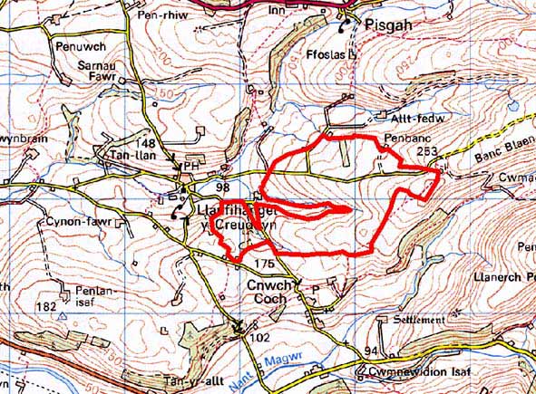
GRID REFERENCE: SN 677759
AREA IN HECTARES: 117.5
Historic Background
The early history of this area has not been researched. By the early 19th century it had been incorporated into the Nanteos estate. An estate map of 1819 (NLW Vol 45, 40) shows part of this area to the south of Allt-fedw Farm as unenclosed sheep pasture, with a few small enclosures encroaching onto its fringes. By the tithe survey of 1847 (Llanfihangel-y-Creuddyn parish) the whole area had been enclosed into the system that survives today. There are no settlements in the area.
Description and essential historic landscape components
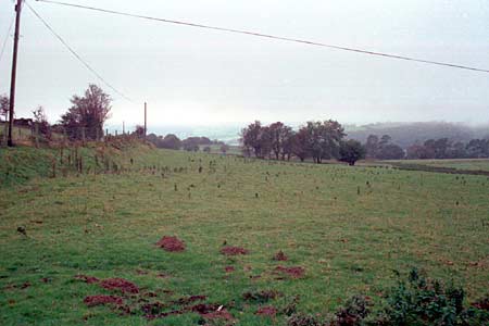
This area lies across the western end of a rounded east-west aligned ridge at a height between 130m -260m. To the west lies lower enclosed land; to the east the land continues to rise to the crest of the ridge. It is the exposed western aspect of this ridge-end that ensured it remained as unenclosed sheep-pasture until the modern period. The area is now divided into medium-sized regular fields. The regularity and late date of the fields indicate enclosure in one action under the aegis of a powerful body, in this case the Nanteos estate. Enclosures are formed from earth banks topped with hedges. Hedges survive in good condition alongside lanes, but elsewhere they are in poor condition and are becoming derelict and overgrown. Everywhere wire fences supplement the historic boundaries. Most land has been converted to improved grazing, but pockets of rougher pasture and rushy ground are evident.
Not a particularly well-defined area. To the west, north
and south this area merges with more ancient enclosed and lower-lying
land. To the east there is better boundary definition, with higher ground
containing enclosed large fields now stripped of hedges.
Base map reproduced from the OS map with the permission
of Ordnance Survey on behalf of The Controller of Her Majesty's Stationery
Office, © Crown Copyright 2001.
All rights reserved. Unauthorised reproduction infringes Crown Copyright
and may lead to prosecution or civil proceedings. Licence Number: GD272221