Home > Historic Landscape Characterisation > Upland Ceredigion > |

 BANC BWLCH ROSER
GRID REFERENCE: SN 700864
AREA IN HECTARES: 123.2
Historic Background
The history of this block of upland is unknown. It was not enclosed until after 1840, and was therefore probably considered Crown land. Post 1840 saw the division of this area into large enclosures and the foundation of at least two farmsteads, which are now deserted.
Description and essential historic landscape components
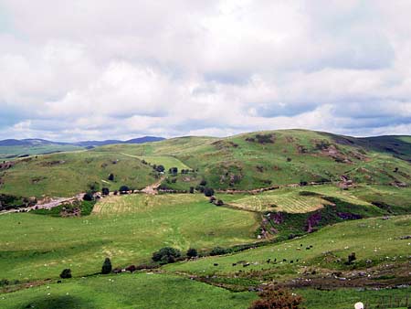
Banc Bwlch Roser is characterised by craggy hills and ridges lying between high upland to the east and lower-lying enclosed land to the west. This area achieves a height of over 320m, with lower slopes dropping down to 220m. It is a treeless landscape that has been divided into large enclosures by earth banks. These are now largely redundant and a few wire fences provide stock-proof boundaries. Improved grazing dominates, though there is rougher ground on steep slopes, and some peaty and rushy hollows are present. Traces of metal mining levels lie on south-facing slopes. The two deserted farms in this area have not been examined in the field.
Recorded archaeology includes a possible standing stone and a possible ring barrow, both of Bronze Age date.
This is a distinct area; acting as a buffer zone between open moorland to the east and lower lying enclosed land to the west. The boundaries between this area and the valleys to the north and south are less clear, but nevertheless are apparent on the ground.
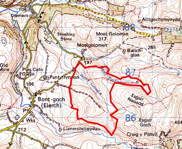
Base map reproduced from the OS map with the permission
of Ordnance Survey on behalf of The Controller of Her Majesty's Stationery
Office, © Crown Copyright 2001.
All rights reserved. Unauthorised reproduction infringes Crown Copyright
and may lead to prosecution or civil proceedings. Licence Number: GD272221