Home > Historic Landscape Characterisation > Upland Ceredigion > |

 LLETY SYNOD & FRONGOCH
GRID REFERENCE: SN 722745
AREA IN HECTARES: 761.3
Historic Background
During the Dark Ages Llantrisant Church with its three early Christian monuments was a focus for Christian worship. However, it did not develop into a parish church, and by the early 19th century was neglected. The present building is late19th century. The settlement focus by then had shifted to Trisant where chapels and a school were constructed.
Part of this area’s southeastern corner once lay within Strata Florida Abbey’s upland grange of Cwmystwyth, as a document drawn up in 1545-50 on the Dissolution of the monastery records the farm of Dol-y-gors (Morgan 1991). It would seem by this date that the grange was divided and leased into farms that were farmed on an individual and commercial basis. The Herbert family acquired Dol-y-gors, and it eventually formed part of the Hafod estate. In the 16th century Morris ap Richard was busily acquiring farms and land to add to his embryonic Trawscoed estate. Amongst his purchases in this area were the farms of Llety Synod and Llwynwnwch, bordering on Frongoch (Morgan 1997, 35). Morris or his descendants must have made other purchases as much of this area had been incorporated into the Trawscoed estate by the late 18th century. Trawscoed estate maps of 1781 (NLW Crosswood Deeds No 5, Ser IV, Vol 1; 22 and 24), showing Frongoch, Llety Synod, Blaen-pentre, Cerrig-yr-wyn, Ty’n bwlch and Llwynwnwch, depict a landscape of scattered, isolated farms adjacent to which are one or two small enclosures surrounded by a few large hay fields, open moor and turbary. The situation had not changed significantly when the tithe survey was undertaken in 1847 (Llanfihangel y Creiddyn parish).
Lead and zinc mining, centred on Frongoch, are an important element of the historic landscape. Up to the 1790s mining here was a small-scale affair, but the operation expanded rapidly under the promotion of John Probert (Bick 1986, 7), but did not achieve its full potential until 1834 when the Lisburne Mines company was formed (Bick, 1974, 13). An engine house was built and other improvements made. In 1899 a Belgian firm took over the running and made further improvements, but by 1910 mining had virtually ceased. Bick (1974, 16) describes Frongoch as containing ‘probably the best collection of 19th century mine buildings in Wales.’
Description and essential historic landscape components
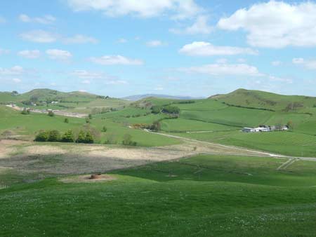
This large and complex area consists of an undulating plateau ranging in height from 220m to 340m, with wet hollows and occasional craggy outcrops and peaks. Almost all the land comprises improved grazing, though peaty and rushy patches can be found in valley bottoms and rougher grazing on some steep slopes. Apart from conifer plantations and small stands of broadleaf woodland, it is virtually a treeless landscape. Settlement is of dispersed farmsteads, with a small cluster of buildings at Trisant which include a listed mid 19th century chapel. Local stone is the traditional building material with slate (north Wales slate) used for roofs. Walls are usually cement rendered on houses, but some bare stone examples are present, and always bare on traditional farm buildings. Older farmhouses/houses almost entirely date to the mid-to-late 19th century, are relatively small, and of two storeys or one-and-a-half storeys. They are built in the typical Georgian vernacular style, with gable end chimneys, a central front door, and two windows either side of the door and one above. However, more dominant vernacular traits are present, such as low eaves, small windows and one chimney larger than the other, but at least one house with strong Georgian elements is recorded. Stone-built outbuildings are generally confined to two or three ranges, sometimes set semi-formally around a yard. Several farms are not now working, and there are several abandoned farms. Working farms have large ranges of modern steel and concrete agricultural buildings, which are often prominent elements of the landscape.
The field pattern is one of large, irregular enclosures. These were once divided by earth banks, which are now redundant or augmented with wire fences. Closer to farms enclosures are smaller, but still irregular, with occasional hedges on the earth banks. These hedges are not in a good condition and are rarely stock-proof - all are supplemented with wire. The physical remains of mining are much in evidence and form an important element of the historic landscape. Frongoch mine buildings are of national importance, though in a poor state of preservation. The site is now used as a timber yard. Associated with the mine are further landscape components such as spoil heaps, reservoirs and leats. The reservoirs in particular are dramatic elements of the landscape.
The recorded archaeology of this area is dominated by the metal mining industry, and by deserted farmsteads and cottages. A Bronze Age round barrow and a hearth or burnt mound - a possible settlement site - of similar date provide time-depth to the landscape. This is emphasised by the three early Christian monuments at Llantrisant, and by the place-name Llety Synod, which may indicate a Medieval hospice.
It is the mining component of this Historic Landscape Area that defines it from its neighbours. Only to the southwest are mining features present to such a degree. To the north is a more settled area, to the west higher formerly unenclosed land, to the south and east squatter settlements, and to the southeast lower-lying enclosed land.
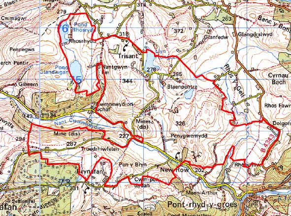
Base map reproduced from the OS map with the permission
of Ordnance Survey on behalf of The Controller of Her Majesty's Stationery
Office, © Crown Copyright 2001.
All rights reserved. Unauthorised reproduction infringes Crown Copyright
and may lead to prosecution or civil proceedings. Licence Number: GD272221