Home > Historic Landscape Characterisation > Upland Ceredigion > |

 ALLT GOCH
GRID REFERENCE: SN 671813
AREA IN HECTARES: 54.2
Historic Background
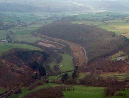
Although historically part of this area may have lain within Cwm-hir Abbey’s Nantyrarian Grange, it is likely that the very steep slopes on which it is located have always determined its use as woodland. Certainly in 1791 it is wooded, as depicted on the earliest map of the area (NLW Powis Castle 164). The area of woodland in 1791 is similar to that of today. Historic maps show it has not altered significantly during the last two centuries, although the Forestry Commission has replanted some stands of broadleaf woodland with conifers. Evidence of lead mining can be found throughout the woodland, but the main workings lie outside this area to the south. It is clear that careful management by the Powis Castle estate, and more recently by the Forestry Commission, has preserved this woodland from the ravages of the lead mining industry, and prevented its piecemeal felling by tenant farmers and other individuals.
Description and essential historic landscape components
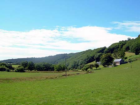
A very steep, heavily wooded valley side lying between 60m and 220m. The woodland is a mixture of hardwoods and conifers. Within the woodland are evidence of spoil tips, shafts and adits of the lead mining industry.
This area is well defined, with lower-lying enclosed farmland to the south and higher enclosed farmland to the north.
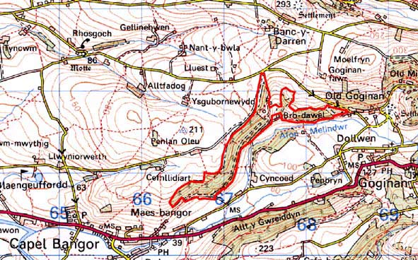
Base map reproduced from the OS map with the permission
of Ordnance Survey on behalf of The Controller of Her Majesty's Stationery
Office, © Crown Copyright 2001.
All rights reserved. Unauthorised reproduction infringes Crown Copyright
and may lead to prosecution or civil proceedings. Licence Number: GD272221