Base maps reproduced from the OS map with the permission
of Ordnance Survey on behalf of The Controller of Her Majesty's Stationery
Office, © Crown Copyright 2001. All rights reserved. Unauthorised reproduction
infringes Crown Copyright and may ead to prosecution or civil proceedings.
Licence Number: GD272221
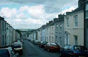
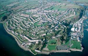
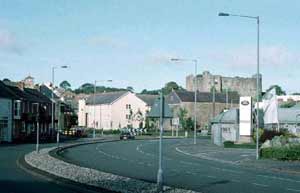
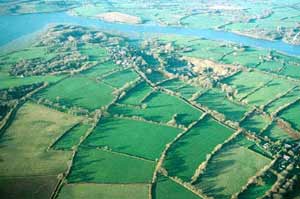
Pembroke
is an urban historic landscape character area that includes Pembroke
Castle, the linear old town encompassed by medieval town walls,
modern housing and other developments on the town’s fringe.
|
|
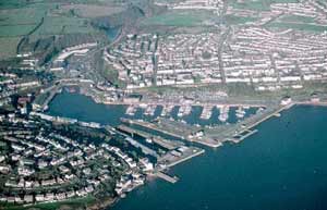
Pembroke
Dock historic landscape character area comprises the 19th
century naval dockyards and the 19th century grid-pattern planned
town. Included in this area are many 19th century worker and town
houses, with 20th century housing and light industrial development
on its outskirts. |
|
Milford
Haven historic landscape character area is a late 18th
century grid-pattern planned town with docks dating to the late
19th century. Large 20th century housing estates and light industrial
developments surround the town’s older core. |
|
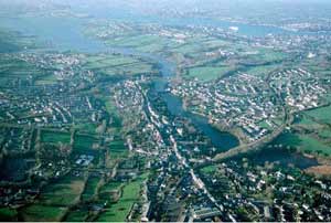
Neyland
is a small urban historic landscape character area centred on the
old port and railway station. The town expanded from this focus
during the 19th century to include the former village of Great Honeyborough.
Late 20th century housing and light industrial development lie on
the outskirts of the town. |
|
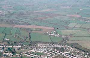
Haverfordwest
is the largest urban area in Pembrokeshire. This historic landscape
character area includes the historic core of the town, dominated
by the castle, medieval churches, fine 18th century and 19th century
houses and the commercial centre, as well as modern development
within and on the town’s fringes. |
|
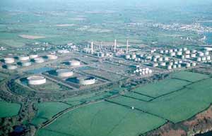
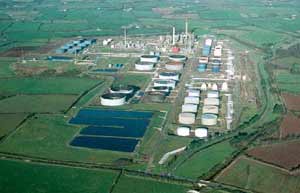
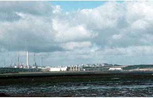
Gulf
Oil Refinery historic landscape character area comprises
the massive structure of this late 20th century industrial complex
including railways and jetties. |
|
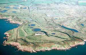
Esso
Oil Refinery historic landscape character area consists
of the dismantled remains of a late 20th century oil refinery. All
that remains are earthworks marking the sites of various installations
and a few ancillary buildings. Included in this area is South Hook
fort, a large 19th century defensive structure. |
|
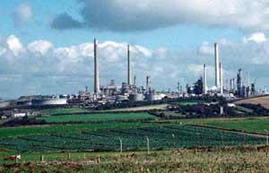
Amoco
Oil Refinery historic landscape character area consists
of a massive industrial complex. |
|
Pembroke
Power Station historic landscape character area is the
site of the late 20th century power station. The station has been
decommissioned and the massive structure is currently being demolished. |
|
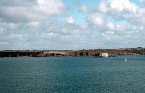
Texaco
Oil Refinery historic landscape character area includes
the massive late 20th century industrial complex, the old BP oil
pumping station located in Fort Popton, a 19th century defensive
structure, and a short length of sea-cliff top. |
|
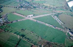
Dale
Airfield lies in an exposed position on the edge of high
sea cliffs. This historic landscape character area consists of the
old runways and some of the buildings of the World War 2 airfield.
Land between the runways has been restored to pasture.
|
|
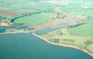
Mullock
Bridge historic landscape character area is a long strip
of land located in a valley bottom that does not contain any settlements,
but is dominated by tidal muds, salt marsh and bog. A road crosses
this area via the historic Mullock Bridge. |
|
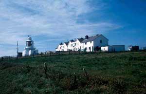
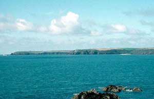
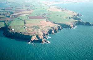
St Ann’s
Head historic landscape character area is a peninsula that
protrudes across the mouth of the Milford Haven waterway. It is
a plateau of rich, windswept farmland characterised by scattered
farms with large regular fields. Included are lighthouses and service
houses, and two 19th century cliff-top forts – Dale and West
Blockhouse. |
|
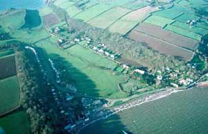
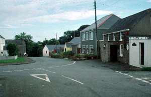
Dale
historic landscape character area is centred on the small village
of Dale, but includes a few dispersed farms set in small regular
fields. Dale village consists of several fine early 19th century
buildings clustered around the waterfront. Twentieth century houses
are located on the fringes of the village, and car parks and other
facilities have been developed to service water sports activities. |
|
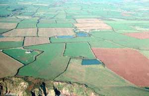
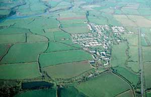
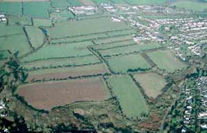
Hoaten – Hasguard is a
very large agricultural historic landscape character area that has
many substantial farms set in a virtually treeless windswept landscape
of large, regular fields. Many of the farmhouses are in the Georgian
style, but with some showing signs of earlier periods of construction.
|
|
St Ishmael’s
historic landscape character area is centred on the loosely clustered
village of St Ishmael’s where most of the buildings date to
the late 19th century and 20th century. Enclosed strip fields –
former open fields – surrounded the village. Also included
is the parish church, standing isolated in a heavily wooded valley,
and 19th century garden features. |
|
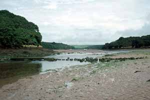
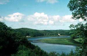
Sandy
Haven historic landscape character area is a ribbon of
tidal mud, salt marsh and bog, with dense deciduous woodland on
the steep valley sides. There are no settlements. |
|
Scoveston
and Burton is predominantly an agricultural historic landscape
character area containing several mansions, many large farms, a
scattering of smaller farms and dispersed modern settlement. Burton
is the only village. Fields in this area are large and are divided
by banks and hedges. Woodland is not a major component of the landscape.
|
|
Houghton
is a small historic landscape character area centred on the hamlet
of that name and surrounded by an enclosed strip-field system –
the old open fields of the community. The loosely clustered houses
in the hamlet are of 19th century and 20th century date. |
|
Hook
historic landscape character area has evolved out of the now defunct
coal mining industry. It consists of several small 19th century
hamlets linked by late 20th century linear development. Included
are three small old coal quays. The agricultural landscape is one
of small irregular fields. |
|
Little
Milford was an important coal exporting port, but this
historic landscape character area comprises mostly woodland on steep
valley sides and mud and salt marsh on the fringes of the waterway.
There is little to indicate its former industrial importance. |
|
Freystrop
includes the hamlet of Lower Freystrop, the detached parish church,
and strip fields – the old open fields of the community. Essentially
this is an agricultural historic landscape character area of dispersed
farms, fields, boundaries of hedges on banks, and woodland. |
|
Uzmaston
and Boulston includes the upper reaches of the Milford
Haven waterway, but mostly comprises dispersed farms set in a landscape
of large, regularly shaped fields. Farms vary in size from the very
large mansions with home farms to 19th century vernacular farmhouses
and small-holdings. |
|
Hillblock
is a very small but historically distinct historic landscape character
area based on an agricultural hamlet of 19th century houses which
is surrounded by an enclosed but degraded strip field system –
the community’s former open fields.
|
|
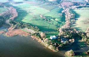
Picton
and Slebech is an estate-based historic landscape character
area. It includes the mansions, gardens, parks and other components
of two of the largest estates in southwest Wales; Picton and Slebech.
The whole area has a ‘parkland’ quality. |
|
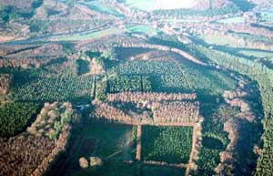
Canaston
and Minwear Woods historic landscape character area consists
of woodland, most of which is now coniferous plantation, but historically
was deciduous. Included in this area is the Georgian mill at Blackpool. |
|
Toch
is an agricultural historic landscape character area comprising
dispersed farms set in a landscape of large, regularly shaped fields
and woodland. |
|
Minwear
is an agricultural historic landscape character which contains
dispersed farms, large fields separated by hedges on banks and woodland.
There are no villages, and the only clustering of dwellings is at
Minwear where the medieval parish church is located. |
|
Martletwy
historic landscape character area contains a fairly dense scattering
of 19th century and 20th century houses set against an agricultural
landscape of dispersed farms, small, irregular fields and much woodland.
Old quays and other installations testify to the former importance
of the coal mining industry in this area. |
|
Lawrenny
village consists of a grouping of mainly 19th century houses close
to the large medieval parish church. However, the main character
of this area is agricultural, with a strong estate or ‘parkland’
appearance originating from the now demolished Lawrenny house. A
large quay testifies to the former importance of coal shipping. |
|
Cresswell
Quay is a former industrial historic landscape character
area with a strong agricultural element. Early 19th century houses
on the quay, the quay itself and a fairly dense scatter of cottages
are evidence of former industry. Agriculture is represented by small,
dispersed farms and small fields. There is dense woodland along
the steep valley sides. |
|
West
Williamston and Carew Newton is an agricultural historic
landscape character area that includes two hamlets and enclosed
strip fields – the former open fields of the two communities.
Hedges on banks form most of the boundaries, but mortared stonewalls
and dry-stone walls are also present. Abandoned quarries, some with
quays testify to the former importance of the limestone extraction
industry.
|
|
Carew
Airfield historic landscape character area consists of
the old runways and few surviving buildings of a World War 2 military
airfield. |
|
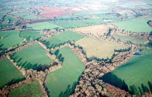
Carew
Milton and Nash is a large agricultural historic landscape
character area that contains several mansion houses set in parkland
and gardens, many large farms and a scattering of smaller farms.
Fields are large and are divided by hedges on banks. Woodland is
a strong component of parts of the landscape. |
|
Cosheston
is a small historic landscape character area that is centred on
the linear village of Cosheston. Most of the houses in the village
date to the 19th century and 20th century. Narrow strip fields surround
the village – the enclosed open fields of the community. |
|
Hundleton
and Maiden Wells historic landscape character area includes
the two said villages set in a landscape of dispersed farms and
fairly small fields. In the villages, modern housing surrounds older
buildings which are mostly 19th century in date. |
|
Rhoscrowther
is a large agricultural historic landscape character area typified
by large dispersed farms with regularly shaped fields. Hedges on
banks are the most common boundary type, but towards the windswept
western part of the area mortared stonewalls are present. There
is a great variety in domestic building type, ranging in date from
the medieval to the 20th century.
|
|
Angle
is a distinctive and complex historic landscape character area.
It is centred on the linear village of Angle, which includes medieval,
19th century and 20th century examples of domestic architecture.
Also included is a harbour area, strip fields – the enclosed
medieval open fields of the community – a 19th century fort
and steep, wooded coastal slopes. |
|
Angle
Airfield historic landscape character area consists of
the site of a World War 2 military airfield which has been restored
to farmland. |
|
Liddeston
is a small historic landscape character area situated on the fringes
of Milford Haven town and consisting of dispersed farms and fields,
a golf course and industrial installations. Although it is predominantly
agricultural, many of the historic landscape components are degraded
owing to the proximity of the town. |
|
Herbrandston
is an agricultural historic landscape character area composed of
dispersed farms and large regular fields. Farms and farmhouses are
generally large, although smaller examples are also present. The
only nucleated settlement is Herbrandston village, which has a core
of 19th century houses surrounded by modern development. |
|
Benton
historic landscape character area is situated on the bank of the
Milford Haven waterway. It mostly comprises deciduous woodland,
but includes the rocky and muddy foreshore, small former shipping/ferry
points and a handful of 19th century dwellings. |
|
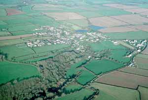
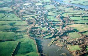
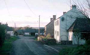
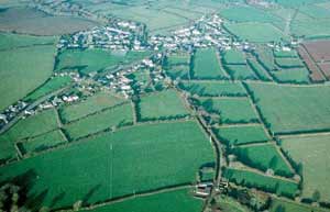
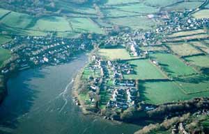
Llangwm
is a village that has developed around the head of a branch of the
Milford Haven waterway. Although medieval in origin, the settlement
expanded in the 19th century as a coal-mining centre and coal port,
but little now survives to indicate this former function. Late 20th
century housing surrounds the historic village core. |
|
Waterston
– Honeyborough is predominantly an agricultural historic
landscape character area of dispersed farms and strip fields, but
includes the village of Waterston and the hamlet of Honeyborough.
The strip fields – enclosed open fields of the communities
– were formerly more extensive but have been encroached upon
by industry and housing. |
|
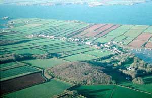
Rosemarket
historic landscape character area is centred on the village
of Rosemarket, but includes a small area of surrounding fields and
steep, wooded valley sides. The village retains its morphology from
an earlier period, but apart from the medieval parish church, most
of the buildings date to the 19th century and 20th century. |
|
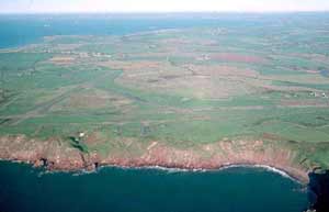
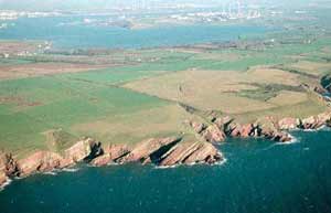
Dale
to St Bride’s Coastal Strip historic landscape character
area consists of a narrow band of cliff-top rough ground. The Pembrokeshire
Coast Path runs through this area, and several iron age hillforts
lie within it. |
|
Monk
Haven to Gelliswick Coastal Strip is a narrow bank of cliff-top
rough ground through which runs the Pembrokeshire Coast Path. Included
in this area are iron age forts and a lighthouse. |
|
West
Angle to Freshwater West Coastal Strip comprises several
kilometres of cliff top along which the Pembrokeshire Coastal Path
runs. Included in this area are iron age forts, a 16th century gun
tower and 20th century gun batteries. |
|