Home > Historic Landscape Characterisation > Milford Haven Area > |

ANGLE AIRFIELD 
GRID REFERENCE: SM 860018
AREA IN HECTARES: 112
Historic Background
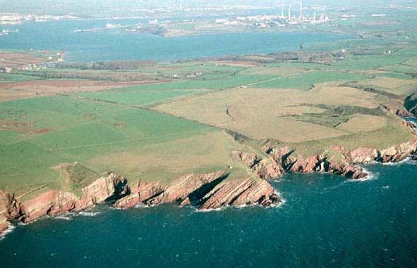
A character area that lies near the western tip of the south Pembrokeshire
peninsula consisting of the restored remains of Angle airfield. It lies
within the parish of Angle, which is probably coterminous with the medieval
Manor of Angle. The manor was a mesne lordship of the Lordship of Pembroke
representing 2 knights’ fees. It formed part of the de Clare share
of the Lordship of Pembroke when it was partitioned in 1247, but in matters
of administration remained subject to Pembroke. The 14th century manor
comprised 2½ carucates of land. By 1613 it was in the hands of
the Earl of Essex. Ultimately Angle came to lie within the extensive Cawdor
Estate under the Campbells of Castlemartin manor. In 1805, the estate
was acquired by John Mirehouse of Brownslade. Prior to the airfield opening
in 1942 the landscape consisted of fields. To the north these fields comprised
enclosed strips of the former open field system of Angle village. To the
south the fields were large and regular, belonging to North Studdock and
Hubberton, both of which were post-medieval farms partly established over
the former open fields, but possibly partly comprising new enclosure.
Fighter aircraft were deployed at Angle for the protection of Atlantic
conveys on their final leg of the journey from America. Aircraft also
performed ground attacks and strikes on shipping in and around the coast
of northern France. Because of its relative remoteness the airfield became
a training and research and development centre. The Coastal Command Development
Unit was based at Angle and Dale airfields. Angle airfield closed within
five years of the end of World War 2.
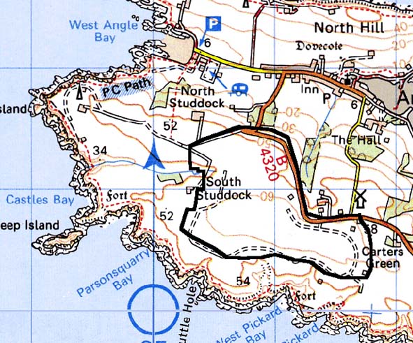
Base map reproduced from the OS map with the permission
of Ordnance Survey on behalf of The Controller of Her Majesty's Stationery
Office, © Crown Copyright 2001.
All rights reserved. Unauthorised reproduction infringes Crown Copyright
and may lead to prosecution or civil proceedings. Licence Number: GD272221
Description and essential historic landscape components
This historic landscape character area consists of farmland reclaimed
from the World War 2 Angle airfield. All the airfield buildings within
this area have been demolished (some World War 2 buildings are utilised
as farm buildings in the neighbouring area) and apart from small sections
the concrete runways and roads removed. The land has been restored to
pasture and is divided by banks and wire fences.
Restoration of the land has blurred the boundary between the airfield and the surrounding farmland, although the nature of the restoration enables the position of the former airfield to be located.
Sources: Angle parish tithe map 1842; Charles 1992; Ludlow 1997a; MOD Plan AE 492