Home > Historic Landscape Characterisation > Milford Haven Area > |

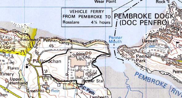
PEMBROKE POWER STATION 
GRID REFERENCE: SM 932025
AREA IN HECTARES: 91
Historic Background
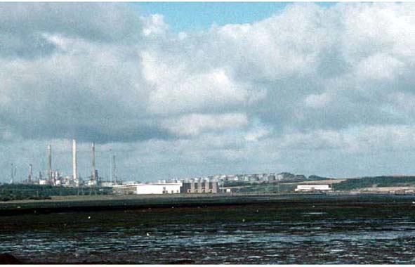
This historic landscape character area is entirely occupied by Pembroke
Power Station. It lies within the eastern half of Pwllcrochan parish,
whose church in the medieval period was a possession of the Benedictine
Monkton Priory, at Pembroke. However, it did not form a manorial centre,
and lands in this part of the parish may have been part of the greater
Manor of Castlemartin, a demesne manor of the Lordship of Pembroke, and
the most important holding appurtenant to Pembroke Castle. Prior to the
construction of the power station much of the area was occupied by an
inlet and was intertidal, comprising mudflats and saltmarsh. The coastline
of this inlet appears to have remained stable throughout the historic
period. The remainder of the area comprised farms with regularly shaped
fields. The power station was commissioned in the early 1960s and decommissioned
in the l990s. It is currently being demolished.
Base map reproduced from the OS map with the permission
of Ordnance Survey on behalf of The Controller of Her Majesty's Stationery
Office, © Crown Copyright 2001.
All rights reserved. Unauthorised reproduction infringes Crown Copyright
and may lead to prosecution or civil proceedings. Licence Number: GD272221
Description and essential historic landscape components
This historic landscape character area comprises the partially demolished
oil-fired power station. In order to build the station a large platform
was constructed by excavating a deep scoop into farmland and dumping the
resulting waste over the head of a small tidal inlet of the Pembroke River.
The resulting platform was large enough to accommodate two stations, should
a second one have been required. The platform will remain after demolition.
Even after total demolition, this area will contrast sharply with neighbouring farmland.
Sources: Jones 1987; Laws 1909; Ludlow 1998; Murphy 1995; Owen 1918;
Pwllcrochan Parish Tithe Map 1840; PRO D/ANGLE/92; PRO HDX/198/2