Home > Historic Landscapes > Black Mountain and Mynydd Myddfai > |

230 PEN-ARTHUR PLANTATION 
GRID REFERENCE: SN 717241
AREA IN HECTARES: 281.10
Historic Background
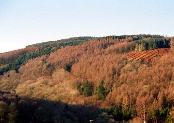
A small character area on the northwestern flank of the Black Mountain
in the valley of the Afon Sawdde. It was once part of Cwmwd Perfedd of
Cantref Bychan which was invaded by the Anglo-Normans under Richard Fitz
Pons who established a caput at Llandovery in 1110-16 (Rees n.d.). It
was acquired soon after by the Clifford lords of Brecon as the Lordship
of Llandovery but retained native tenurial customs until the end of the
Medieval period when it was incorporated within the modern Carmarthenshire.
The area lay in the further division of Maenor Gwynfe, and within the
ecclesiastical parish of Llangadog. The medium-sized irregular enclosures
contrast with the larger, regular enclosures to the west - which are 19th
century enclosure of former common - and are probably earlier, though
possibly Post-Medieval. The area contains two farmsteads, Pen-Arthur and
Pen-Arthur-isaf, a subdivision of a larger holding with an interesting
name. In addition are two Lletty place-names; the steep-sided valley of
the Afon Sawdde is a natural line of communication and the present A4069
was a major Post-Medieval droving route. A pound, and a possible fold,
were established around the bridge over the Sawdde at Pont-ar-llechau,
which became a place of some importance and occasional venue of the court
leets of Myddfai (James n.d., 87). The road was turnpiked from 1779 (Lewis
1971, 43) encouraging further, commercial settlement at Pont-ar-llechau
with the establishment of two public houses (both now closed), a tile
quarry and a former woollen factory. A second woollen factory formerly
lay at the west end of the area at Glandwr. There has been no recent development
and the entire area is given over to later 20th century conifer plantation.
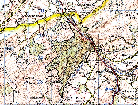
Base map reproduced from the OS map with
the permission of Ordnance Survey on behalf of The Controller of Her Majesty's
Stationery Office, © Crown Copyright 2001.
All rights reserved. Unauthorised reproduction infringes
Crown Copyright and may lead to prosecution or civil proceedings. Licence
Number: GD272221
Description and essential historic
landscape components
Pen-Arthur plantation lies over the eastern end of a ridge, which achieves
heights of over 300 m, and covers the steep valley sides of the Afon Sawdde.
Prior to afforestation several widely dispersed settlements were present
and the whole of the area had been enclosed into medium- and large-sized
enclosures. Earth and earth and stone banks of these enclosures survive
under the plantation. Map evidence indicates that several dwellings survive
in small clearings in the forestry - these were not examined in this study.
The A4069/former turnpike runs down the Sawdde valley and so passes through
this area. Apart from these early landscape elements, most of the historic
components comprise tracks, drives and other features associated with
the forestry.
Recorded archaeology provides the landscape with great time-depth comprising a possible Neolithic chambered tomb and an Iron Age hillfort, in addition to the Post-Medieval woollen factory sites and tile quarry.
There are no distinctive buildings but the former Three Horseshoes and Coopers Arms public houses at Pont-ar-llechau, adjacent to the former turnpike toll house, bridge, pound (and a sheepfold?), should be noted for historical value.
This area of forestry plantation is well defined by the neighbouring enclosed farmland and by semi-open high ground.