Home > Historic Landscapes > Black Mountain and Mynydd Myddfai > |

197 TRAP 
GRID REFERENCE: SN 647185
AREA IN HECTARES: 634.30
Historic Background
A small character area within the foothills of the Black Mountain, once
part of Maenor Llys which occupied the eastern part of Iscennen commote.
Iscennen, unlike the rest of Cantref Bychan within which it lay, remained
nominally independent of Anglo-Norman rule until 1284 when it was acquired
by John Giffard. In 1340 it became a member of the Duchy of Lancaster
(Rees 1953, xv-xvi). Area 197 may have formed part of the estate of the
maerdref of Carreg Cennen (see Area 198); at any rate a gentry house,
Cwrtbrynbeirdd, had been established within the area by the late Medieval
period, which may indicate the subdivision of a larger estate. Cwrtbrynbeirdd
is a hall-house occupied by Morris Owen in the 15th century (Jones 1962,
259) and may be associated with the enclosure of common land in the neighbouring
Area 199 with its rabbit warren. The surrounding system of medium-sized,
curvilinear enclosures contrasts sharply with the smaller, more irregular
enclosures of the remainder of the character area and it may be that the
landscape was reorganised with the establishment of the house, which was
later part of the Golden Grove estate (Jones 1987, 17). Carreg Cennen
house was a de novo establishment of the nabob Thomas Wright Lawford in
1806 and has no link, apart from the name, with Carreg Cennen Castle (Area
256), but it appears to occupy the site of a Medieval grange to Talley
Abbey (Owen 1894, 35). The area, like much of Llandeilo Fawr parish, has
an ecclesiastical signature; further monastic land lay to the east, a
Medieval chapel (of ease to Llandeilo Fawr?) lay south of Cwrtbrynbeirdd,
and a cist cemetery lay to the west. A further chapel may have been present
near Trap where the present nucleation, however, belongs to the late 19th-
and 20th-century; the present landscape had been established by the time
the tithe map of Llandeilo Fawr parish had been drawn up (1841), but the
mill and a roadside inn, the Cennen Arms, are the only buildings shown
at Trap.

Base map reproduced from the OS map with
the permission of Ordnance Survey on behalf of The Controller of Her Majesty's
Stationery Office, © Crown Copyright 2001.
All rights reserved. Unauthorised reproduction infringes
Crown Copyright and may lead to prosecution or civil proceedings. Licence
Number: GD272221
Description and essential historic
landscape components
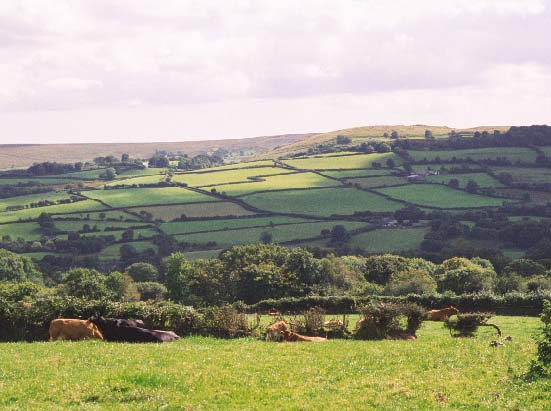
Trap character area lies across the open valley of the Cennen below Carreg
Cennen Castle. The bottom of the valley lies at approximately 100m while
the sides rise up to over 200m on the south side, with much Carboniferous
limestone outcropping. The area is enclosed into a series of small irregular
fields apart from on the south side close to Cwrtbrynbeirdd where medium-sized
more regular enclosures prevail. Earth banks with hedges comprise the
boundaries to all fields, though wire fences supplement most hedges. Hedges
vary in condition, but tend towards the overgrown. Some farms have neatly
maintained hedges. There is a slight tendency to neglect hedges at higher
levels. Many hedges possess distinctive trees, and these together with
overgrown hedges and the many small stands of deciduous trees lend a wooded
appearance to the landscape. Several small conifer plantations are present
in this area. Pasture is the predominant land-use, and while much is improved,
there are large pockets of unimproved and rushy ground both on the valley
sides and valley bottom. The settlement pattern is of dispersed farms
and houses with a loose cluster of buildings at Trap. The dispersed houses
and farmhouses are also mainly 19th century in date and in the vernacular
tradition. Higher status and more ancient buildings such as the large
sub-Medieval and later house at Cwrtbrynbeirdd and the farm at Llwyndewi
provide a greater time-depth and greater social and economic stratification
to the landscape. Most older farm outbuildings are 19th century and stone-built,
but have modern farm buildings associated with them.
Recorded archaeology includes two Bronze Age burnt mounds, while from the Medieval period are a cist cemetery and a possible holy well. Archaeological features along the limestone ridge which forms the southern edge of the area mainly relate to limestone processing, such as quarries, lime kilns and limeworks.
There are a number of distinctive buildings. The remains of the Medieval Capel Dewi are both scheduled and Grade II listed. Immediately to the north is Cwrtbrynbeirdd (Grade II listed) which has 15th-16th century origins, with an original single cusped lancet and later alterations. Carreg Cennen House (Grade II* listed ) is a later gentry house, begun in 1806 possibly to designs by the architect S P Cockerell, and is a fine example of a small Georgian country house with a remarkable staircase hall and a Grade II listed, specialised apiary building retaining its principle features. A formal range of 18th - 19th century farm buildings lies at Llwyndewi. The buildings at Trap are mainly 19th century, stone-built with slate roofs, with houses in both the vernacular- and polite Georgian-tradition. Interspersed with these are late 20th century dwellings in a variety of styles and materials, however, the mill may be earlier and there is a K6 telephone box. The dispersed houses and farmhouses are also mainly 19th century in date and are stone built with slate roofs, and while many are in the vernacular tradition and are of two storeys and three bays, there are examples in the polite Georgian style. Most older farm outbuildings are 19th century, stone-built with the more substantial examples in a semi formal arrangement, though often they are of just one range.
This character area though well defined to the south where it runs up against unenclosed high ground, is less well defined on other sides. To the south, east and west the neighbouring character areas contain similar characteristics and there tends to be a zone of change, rather than a hard-edged boundary, the exception being the small character area of Carreg Cennen Castle to the east.