Home > Historic Landscape Characterisation > Upland Ceredigion > |

 YSBYTY YSTWYTH FIELD SYSTEM
GRID REFERENCE: SN 731710
AREA IN HECTARES: 34.8
Historic Background
The history of this area in the Medieval Period is uncertain. The dedication of Ystbyty Ystwyth Church to St John the Baptist has been taken as in indication that the parish was in the possession of the Knights Hospitaller, but it is perhaps more likely that it belonged to Strata Florida Abbey, perhaps in one of the abbey’s granges (Ludlow 1998). However, nothing certain is known of this area until the late 18th century when an estate map (NLW Crosswood Vol 1) - ‘Map of Sputty Intermixed Lands’- shows the whole of the area as a sub-divided or strip field, with no obvious internal boundaries. This is the only unequivocal evidence for a sub-divided arable field system within the study area of upland Ceredigion. It is assumed that it was the remaining field or part field of a much larger system that was no longer in use by the late 18th century, and had been then consolidated and enclosed. By the tithe survey (Sputty Ystwyth Tithe Map and Apportionment, 1848) the sub-divided fields shown on the estate map had been consolidated and enclosed into the form that exists today. There is no surviving surface evidence to indicate the former presence of a sub-divided field system, and the tithe map gives no indication of its former existence.#
Description and essential historic landscape components
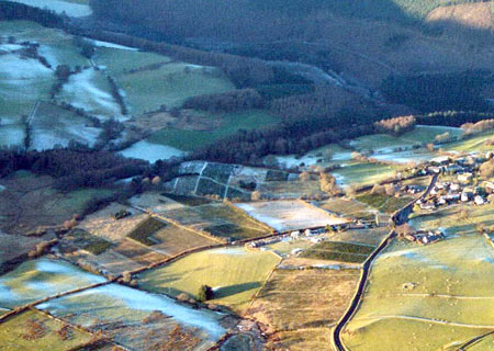
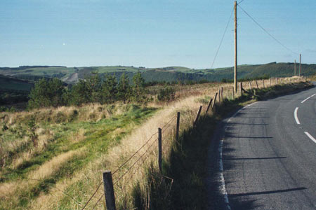
This is small block of undulating land between 210m and 250m, to the south of Ysbyty Ystwyth village, which has been characterised on the evidence of historic maps. The area is divided into small irregular fields separated by earth banks or stone and earth banks topped with hedges. Some hedges have been removed and others are derelict, and most have been augmented by wire fences. Conifer plantations now cover a large portion of the area. Elsewhere there is rough grazing and rush covered ground with a little improved pasture.
The only recorded archaeology in this area is a Bronze Age burnt mound.
The extent of this area not well defined on the ground, and it merges with enclosed land on all sides. However, historically, this area is very well defined.
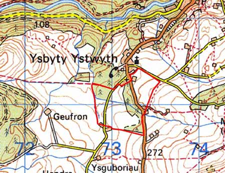
Base map reproduced from the OS map with the permission
of Ordnance Survey on behalf of The Controller of Her Majesty's Stationery
Office, © Crown Copyright 2001.
All rights reserved. Unauthorised reproduction infringes Crown Copyright
and may lead to prosecution or civil proceedings. Licence Number: GD272221