Home > Historic Landscape Characterisation > Upland Ceredigion > |

 UPPER YSTWYTH VALLEY
GRID REFERENCE: SN 830749
AREA IN HECTARES: 129.2
Historic Background
In the Medieval Period this area formed part of Strata Florida Abbey’s Cwmystwyth Grange (Williams 1990). By at least the later Middle Ages the grange had been divided into farms that were leased out and farmed on a commercial basis. A document of 1545-50 (Morgan 1991) records farms in this area. By 1590, the Herbert family had acquired most of the land of Cwmystwyth. Herbert land passed to the Johnes family in 1704. However, the Earl of Essex was granted numerous abbey lands at the Dissolution and subsequently he sold them to the Crosswood estate in 1630. In this manner some land in this area came into the possession of Crosswood. Little is known of the landscape history of this area, but Crosswood estate maps of 1781 (NLW Crosswood Vol 1, 35, 73) show Ty llwyd and Ty mawr farms set in a landscape of small irregular fields on the valley floor. There has been very little change since that date. A chapel was constructed here in 1856 (Percival 1998, 518). The Ystwyth valley provides a route-way onto high ground to the east and over to Rhayader and beyond. In 1770, a turnpike road was constructed through the valley (Colyer 1984, 176-182); this was the main route from Ceredigion to the east for 40 years until a new turnpike, the present A44, superseded it some miles to the north. The road through Cwmystwyth is now a minor route much used by tourists in the summer months.
Description and essential historic landscape components
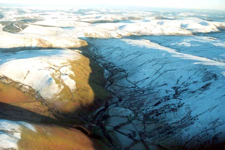
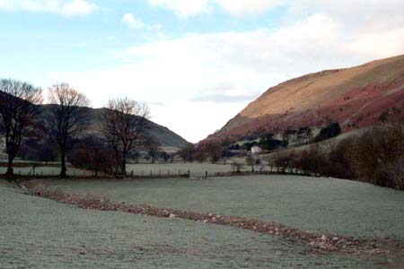
This area consists of the flat valley floor of the upper Ystwyth, together with the lower valley sides of enclosed land. From the valley floor, which lies at 230m to 300m, the valley sides rise steeply to over 500m. The enclosed land on the lower slopes is included in this area. Dry-stone walls and stony banks form the boundaries to fields. Only a few of the banks now support hedges, and these are in a derelict condition. Wire fences now run along most of the older boundaries. Some of the boundaries have distinctive trees on them and there are small stands of scrubby woodland. Farmland mostly comprises improved grazing, but there are many patches of rougher, rushy ground on the valley floor, and some of the fields on the lower slopes are beginning to revert to moorland.
Farms are dispersed along the lower slopes of this area. Apart from a couple of modern houses and bungalows, buildings probably date to the 19th century, are stone built (generally cement rendered on houses), with slate roofs. However, an exception is the house of the largest farm in this landscape, which is a substantial (for the region) Georgian style building probably with 18th century origins. This farm has large stone-built outbuildings. Other farms are smaller with houses in the later 19th century regional Georgian vernacular tradition. Outbuildings on these consist of one or two small stone-built ranges. A deserted farm with stone outbuildings set semi-formally around a yard is present. Working farms have small modern agricultural buildings.
Recorded archaeology of this area is not numerous or diverse. Of interest are the remains of a small metal mine.
This is a very distinct and well-defined historic landscape area. To the west lies the extensive mining remains of Cwmystwyth, on all other sides is high, unenclosed moorland.
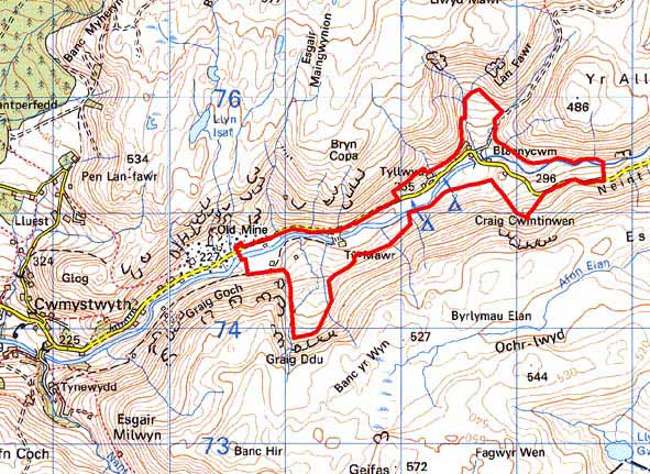
Base map reproduced from the OS map with the permission
of Ordnance Survey on behalf of The Controller of Her Majesty's Stationery
Office, © Crown Copyright 2001.
All rights reserved. Unauthorised reproduction infringes Crown Copyright
and may lead to prosecution or civil proceedings. Licence Number: GD272221