Home > Historic Landscape Characterisation > Upland Ceredigion > |

 TAI-UNNOS
GRID REFERENCE: SN 735634
AREA IN HECTARES: 36.1
Historic Background
In the Medieval Period this area lay with Strata Florida Abbey’s Penardd Grange. As with other abbey granges it is likely that by the end of the Medieval Period, if not earlier, Penardd had been divided into farms, which were leased out on a commercial basis. On the Dissolution of the abbey its lands were granted to the Earl of Essex, who subsequently sold them to the Crosswood estate in 1630. However, it is likely that this area was unenclosed and therefore claimed by the Crown. The first settlements seem to have been squatter or tai-unnos cottages carved out of Rhos Gelli-gron common, perhaps in the late 18th century. There is no documentation for this, though the tithe map of 1845 (Caron parish) shows a well-developed settlement of cottages sitting in a system of small irregular fields. A Sunday school/chapel was built in 1886 to serve the community, and a second one in 1906 (Percival 1998, 520). Oral testimony indicates that the inhabitants worked in the metal mines to the north of Strata Florida. The decline in the mining industry was accompanied by a decline in this settlement. From the early decades of the 20th century population levels steadily fell, though it was not until after World War Two that the final inhabited dwelling was abandoned.
Description and essential historic landscape components
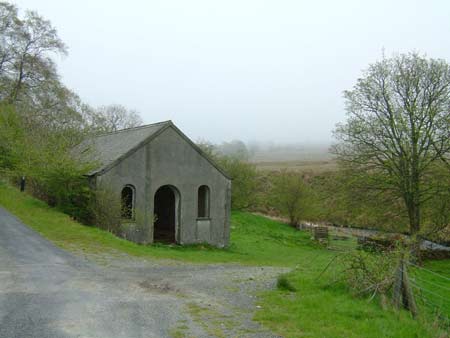
This derelict landscape of late 18th and 19th century settlements lies on the fringe of Rhos Gelli-gron common at between 250m and 320m. Abandoned cottages and houses are dotted across the landscape. These vary from very ruinous, small dwellings to more recently abandoned and more intact substantial stone-built houses. A redundant and a demolished chapel are present. The field pattern is one of small irregular enclosures and paddocks, divided by earth banks originally topped with hedges. Hedges, however, either no longer exist or are derelict, and the landscape is essentially one large unit of rough grazing fenced off from surrounding land.
The recorded archaeology consists entirely of deserted settlements as described above.
This is a distinct and well-defined area. To the south
and west is unenclosed moorland. Forestry lies to the east, and enclosed
settled land to the north.
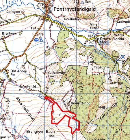
Base map reproduced from the OS map with the permission
of Ordnance Survey on behalf of The Controller of Her Majesty's Stationery
Office, © Crown Copyright 2001.
All rights reserved. Unauthorised reproduction infringes Crown Copyright
and may lead to prosecution or civil proceedings. Licence Number: GD272221