Home > Historic Landscape Characterisation > Upland Ceredigion > |

 PUMLIMON
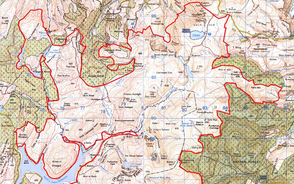
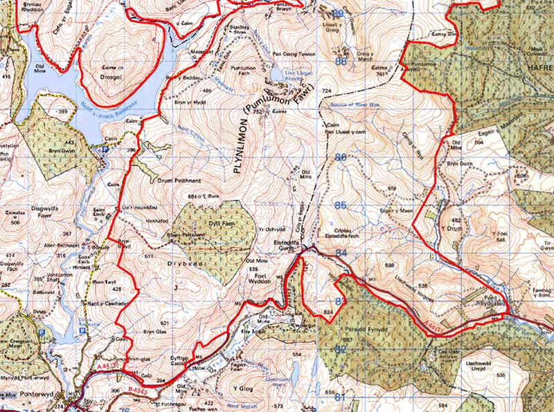
GRID REFERENCE: SN 805884
AREA IN HECTARES: 8986
Historic Background
This very extensive area, which includes the summit of Pumlimon, lies across the county boundary separating Ceredigion from Powys. The Powys side of the boundary has not been examined in detail, and revision of the area may be required if further research is carried out. Included in this area was part of Cwm-hir Abbey’s Cwmbuga Grange. The unenclosed character of most of this land probably ensured that the Crown claimed it. It included the Crown Manor of Perfedd. Records of Cwmbuga Grange indicate considerable sheep-walks and summer pasture - a function that has generally survived across the whole area to the present day. Though there are now no occupied settlements in the area, historical sources indicate that in the 18th century a pattern of dispersed settlement existed. Many of these settlements were referred to as lluest (Vaughan 1966), which may indicate that their origins lay within a system of transhumance. In 1744, Lewis Morris, the Deputy Steward of the Crown Manor of Perfedd, described them as ‘small cottages which were originally summer houses for shepherds and have an inclosure of a few acres of ground annexed to them.’ (Vaughan 1966, 257). Morris seems to have described a system in decline as some of the settlements he lists were deserted. By the end of the 18th century they had declined dramatically in numbers, and by the mid 19th century had all but gone leaving a deserted landscape. Plynlimmon lead mine commenced production in this remote area in 1866 and continued until 1891 (Bick 1983, 6-8).
Description and essential historic landscape components
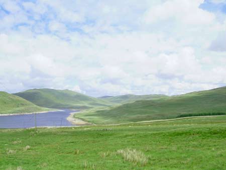
This is an extensive and remote area that includes steep-sided valleys down to 250m and the craggy summit of Pumlimon at 752m. Almost the whole of this area comprises moorland and rough grazing with blanket bog at higher levels and peaty deposits in high valleys and hollows. Old earth bank boundaries formerly divided small portions of the lower slopes into large fields, but these enclosures are now largely redundant, and widely spaced wire fences provide stock-proof boundaries. Large-scale land improvement over the past few decades has resulted in the transformation of much of the lower slopes, and some high level plateaux, into grassland grazing. This is a treeless landscape with no habitations. The spoil tips, shafts, tramways and wheel pits of Plynlimmon lead mine and other metal mines are among the most obvious components of the historic landscape in this area.
Apart from the metal mines mentioned above, the recorded archaeology consists of Bronze Age round barrows/cairns and find spots, and post-Medieval settlement sites and associated remains. The round barrows/cairns located on summits, such as the group on Pumlimon are dramatic elements of the landscape. Post-Medieval settlements, which are concentrated on the lower slopes, indicate a populated landscape until the 19th century.
To the north and east the exact boundaries of this area have yet to be defined. To the west lies upland forestry and the Rheidol valley, including Nant y Moch reservoir. The definition between this area and the reservoir area is not particularly good, and should be considered a zone of change rather than a hard line. To the south the low-lying, enclosed and settled Dyffryn Castell lies in sharp contrast with this upland block.
Base map reproduced from the OS map with the permission
of Ordnance Survey on behalf of The Controller of Her Majesty's Stationery
Office, © Crown Copyright 2001.
All rights reserved. Unauthorised reproduction infringes Crown Copyright
and may lead to prosecution or civil proceedings. Licence Number: GD272221