Home > Historic Landscape Characterisation > Upland Ceredigion > |

 LLETHR LLWYD
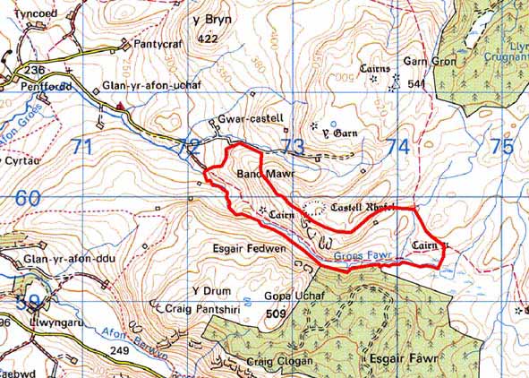
GRID REFERENCE: SN 741598
AREA IN HECTARES: 95.3
Historic Background
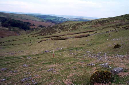
This area is characterised by its open unenclosed aspect. In the historic period its unenclosed nature probably ensured that the Crown claimed it. Settlements of historic character are noted in the archaeological record, but these seem to have been abandoned by the mid 19th century, if not earlier. The prime use of the area in the historic period has been sheep-walk.
Description and essential historic landscape components
This area of unenclosed rough grazing lies on the steep
and occasionally craggy south-facing slopes of the Groes Fawr valley at
between 320 and 500m. Archaeological sites are the main historic landscape
components, and cover two main periods: Bronze Age and post-Medieval.
Bronze Age archaeology consists of several round barrows or burial cairns,
a possible standing stone and numerous clearance cairns and possible house
sites. The clearance cairns are only tentatively assigned to the Bronze
Age; it is possible that they are associated with the later settlement
across the area. This later settlement comprises numerous long huts and
other settlement sites. Some of these may be entirely of Medieval date,
or have their origins in the Medieval Period, but it is more likely that
they were occupied in the post-Medieval period. Some of the recorded settlements
are clearly of post-Medieval date, as are the upstanding walls of the
cottages/farm, cultivation ridges and other traces of agriculture.
Base map reproduced from the OS map with the permission
of Ordnance Survey on behalf of The Controller of Her Majesty's Stationery
Office, © Crown Copyright 2001.
All rights reserved. Unauthorised reproduction infringes Crown Copyright
and may lead to prosecution or civil proceedings. Licence Number: GD272221