Home > Historic Landscape Characterisation > Upland Ceredigion > |

 CORS CARON
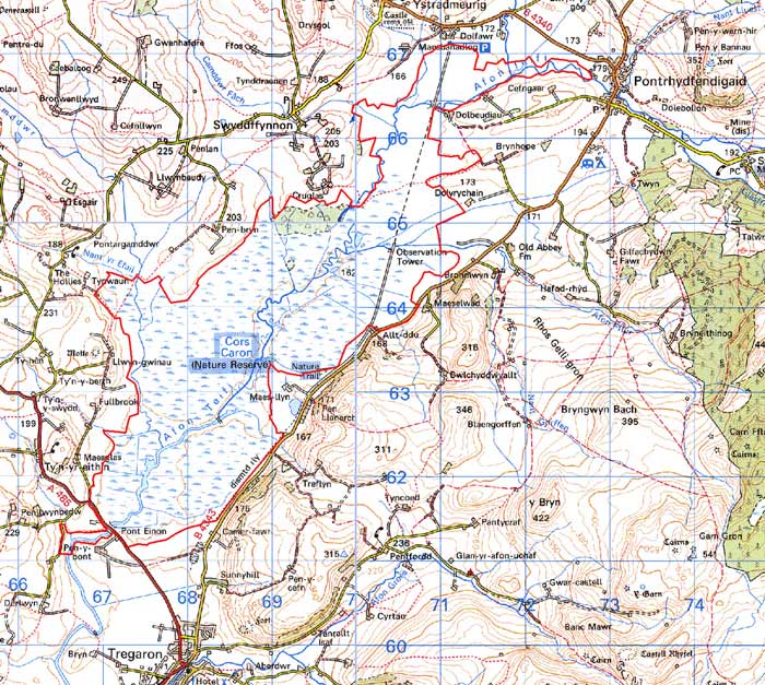
GRID REFERENCE: SN 696640
AREA IN HECTARES: 1067
Historical background
In the Medieval Period the area of Cors Caron was divided between Strata Florida Abbey’s granges of Penardd, Blaenaeron and Mefenydd. The history of this area following the Dissolution is uncertain, but its unenclosed character probably ensured that the Crown claimed it. In all periods Cors Caron has been a source of peat, and provided opportunities for wild-fowling, summer pasture and hay gathering. Peat cutting was concentrated where the bog runs close to Tregaron. In the years following World War One mechanical peat cutting was carried out, but this was short-lived (Countryside Council for Wales 1995). The Milford and Manchester Railway, opened in 1866 and closed in 1964, crosses the bog from south to north. The bog has never been enclosed. Its importance for the historic landscape lies in its record of vegetational history and climate change that is contained within the peat deposits (see Turner 1964). It is now designated a Nature Reserve.
Description and essential historic landscape components
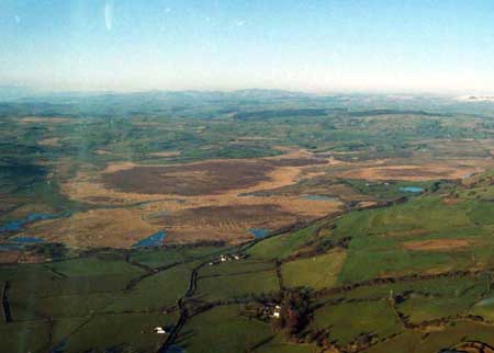
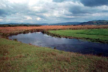
Cors Caron is an area of open, raised bog covering over 1000 hectares at approximately 165m. The River Teifi runs down the centre of the area from north to south. There are several open pools of water on the bog; some of which are artificially maintained. There is surface evidence for past peat cutting, particularly at the southern end close to Tregaron. Some old boundaries are evident on the southern and northern boundaries of the bog, and there is some encroachment of woodland on the northeast side. Apart from these, the entire area is bog.
Recorded archaeology includes the post-Medieval bridge of Pont Einon (dated 1805 and now listed), a possible Medieval trackway and an Iron Age bog burial, the exact location of which is unknown.
Cors Caron is well defined on all boundaries, but particularly
so on the western and eastern sides where the ground rises steeply onto
improved pasture.
Base map reproduced from the OS map with the permission
of Ordnance Survey on behalf of The Controller of Her Majesty's Stationery
Office, © Crown Copyright 2001.
All rights reserved. Unauthorised reproduction infringes Crown Copyright
and may lead to prosecution or civil proceedings. Licence Number: GD272221