Home > Historic Landscape Characterisation > Upland Ceredigion > |

 CAPEL HELAETH
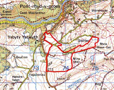
GRID REFERENCE: SN 741710
AREA IN HECTARES: 92.0
Historic Background
The history of this area in the Medieval Period is uncertain. The dedication of Ystbyty Ystwyth Church to St John the Baptist has been taken as an indication that the parish was in the possession of the Knights Hospitaller, but it is perhaps more likely that it belonged to Strata Florida Abbey, perhaps in one of the abbey’s granges (Ludlow 1998). The first large-scale map, the tithe map of 1848 (Sputty Ystwyth Tithe Map and Apportionment, 1848) that includes this area, shows a landscape very similar to that of today. However, the presence of a sub-divided field system immediately to the west of this area in the 18th century provides an indication of what this present landscape may have evolved from. Given the proximity of Ysbyty Ystwyth village, it is possible that this area also once comprised a sub-divided field system that was consolidated and enclosed prior to the survey for the first large-scale maps. The scatter of non-agricultural 19th century houses in addition to farms/smallholdings suggests worker (miners) houses, perhaps self built and established on common land or alongside roads.
Description and essential historic landscape components
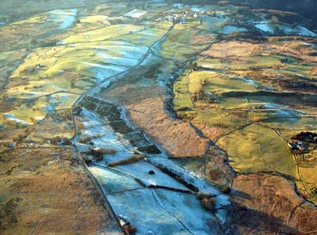
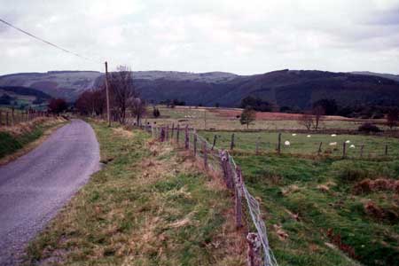
This area comprises a strip of land that rises from 240m at its western end close to 350m at its eastern end and the village of Ysbyty Ystwyth. The settlement pattern is of dispersed farms/smallholdings and houses/cottages set within small irregular fields. Non-agricultural dwellings are mainly distributed alongside a road. Boundaries are of low earth banks giving way to stone-faced banks at higher eastern altitudes. Only a few derelict hedges are present on the banks. Wire fences run along all boundaries. Most of this area is under improved grazing, but some rougher ground is present. Peaty deposits lie in a valley along the northern edge of the area.
Stone – left bare or cement rendered – is the traditional building material with slate for roofs. Houses are small and date to the mid-to-late 19th century (most probably to the late 19th century), of two storeys and in the typical Georgian vernacular style –gable end chimneys, central front door, and two windows either side of the door and one above. Farms have small ranges of 19th century stone outbuildings and small modern steel and concrete agricultural buildings. At the eastern end a ruined deserted farmstead/cottage lies in a pasture field.
Recorded archaeology provides no indication of any time-depth for this landscape, and consists entirely of extant or deserted post-Medieval dwellings and an old chapel.
The borders of this area are not distinct, and in all directions it merges with surrounding areas. To the east and southeast lies higher, rougher ground with large enclosures. Lower lying rougher ground with large enclosures lies to the south and southwest. To the north the landscape is quite different, but there is no clear division between it and this area, and similarly with the area to the west.
Base map reproduced from the OS map with the permission
of Ordnance Survey on behalf of The Controller of Her Majesty's Stationery
Office, © Crown Copyright 2001.
All rights reserved. Unauthorised reproduction infringes Crown Copyright
and may lead to prosecution or civil proceedings. Licence Number: GD272221