Home > Historic Landscape Characterisation > Upland Ceredigion > |

 BLAEN SYCHNANT
GRID REFERENCE: SN 710687
AREA IN HECTARES: 181.3
Historic Background
In the Medieval Period, this area lay within Strata Florida Abbey’s Mefenydd Grange. At the Dissolution of the abbey the granges were granted to the Earl of Essex, who subsequently, in 1630, sold them to the Crosswood estate. It is likely that this relatively high area was unenclosed and therefore claimed by the Crown, but Crosswood did possess part of it as indicated by an estate map of 1781 (NLW Crosswood Vol 1, 66). This shows land to the north of Mynachdy as either unenclosed or enclosed into large fields. It is likely that the Crosswood estate had designs on the Crown land and wished to enclose it. Squatters or cottagers, however, established themselves on the land, much to the chagrin of the estate, which tried unsuccessfully to expel them (Morgan 1997, 211). By the mid 19th century a pattern of squatter cottages with small enclosures and larger more regular estate enclosures had been established across the whole area (tithe survey of 1843). The 20th century has witnessed an abandonment of the settlements and a breakdown of the enclosure pattern.
Description and essential historic landscape characteristics
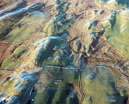
This is an area of undulating, sometimes craggy upland, ranging in height between 200m and 300m. There is a collection of abandoned cottages dispersed across the landscape, and at least one inhabited dwelling - a stone built cottage. These are early 19th century squatter cottages. Surrounding the abandoned cottages are relict field systems of small fields and paddocks with larger fields further out. Boundaries once comprised earth and stony banks and dry-stone walls, but wire fences now divide enclosures. Grazing of improved pasture, sometimes running over old boundary banks, dominates the area, but patches of rougher grazing are present. It is essentially a treeless landscape.
Recorded archaeology in this area consists mostly of deserted cottages and associated remains. There is, however, a metal mine on record, and a Medieval motte - Cwm Meurig Isaf - provides an element of time-depth to the landscape.
To the north and southwest, unenclosed and semi-enclosed upland merges with this area. Elsewhere there is better definition between this area and its neighbours, as the land falls away to lower-lying, settled, enclosed pasture.
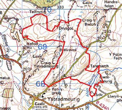
Base map reproduced from the OS map with the permission
of Ordnance Survey on behalf of The Controller of Her Majesty's Stationery
Office, © Crown Copyright 2001.
All rights reserved. Unauthorised reproduction infringes Crown Copyright
and may lead to prosecution or civil proceedings. Licence Number: GD272221