Home > Historic Landscape Characterisation > Upland Ceredigion > |

 AFON MWYRO
GRID REFERENCE: SN 774650
AREA IN HECTARES: 74.4
Historic Background
In the Medieval Period this area lay within Strata Florida Abbey’s Pennardd Grange, perhaps as part of the abbey demesne. The granges were granted to the Earl of Essex on the Dissolution, who sold them to the Crosswood estate in 1630. In the late 18th century some land in this area was in the possession of Crosswood, and may have been obtained by this route. However, John Stedman acquired the Abbey demesne in 1567. Richard Stedman died intestate in 1746 and the estate passed to the Powells of Nanteos. Nanteos had considerable holdings here in the 19th century. It is likely that by the end of the Medieval Period, if not earlier, abbey granges and demesne were divided into farms, which were leased out on a commercial basis. The end result of this process is a settlement pattern similar to that of the present day, as seen on the tithe map of 1845 (Caron Tithe Map and Apportionment, 1845). By 1845 enclosures had been established on the valley floors and in pockets around the farmsteads. This system of small enclosures was to expand during the 19th century to achieve its present form. Population achieved levels in the early 20th century large enough to support the construction of a chapel/schoolroom in 1905 (Percival 1998, 520). Since then there has been a general decline in population.
Description and essential historic landscape components
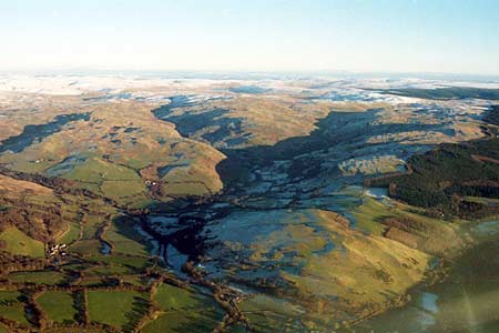
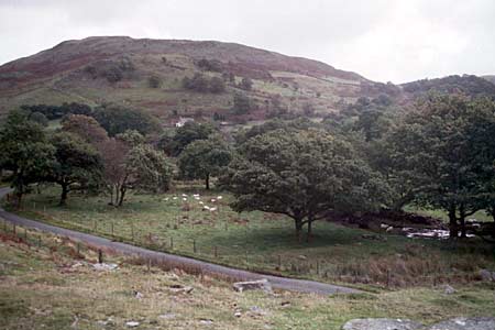
This landscape character area comprises the valley floor and lower valley slopes of the Afon Mwyro, ranging in height from 210m at its western end to 370m at the edge of enclosed land on the valley sides. Small enclosures on the valley floor generally give way to unenclosed moorland/sheep-walk at the break of slope, although in the Tyncwm and Berthgoed farm area enclosed land runs up and over low spurs. The settlement pattern is of dispersed farms and a disused chapel located on low spurs and the lower valley sides. Berthgoed farmhouse is in the typical Georgian vernacular mid-to-late 19th century style of the region, of rendered stone with a commercial slate roof. It has large modern agricultural buildings. There is also a large isolated modern farm building on the valley floor. Boundaries comprise dry-stone walls with some rubble banks. Hedges, where present, are derelict, and most of the boundaries are supplemented with wire fences. Improved grazing is present in most of the enclosures on the valley floor, but tending to rougher pasture on the lower slopes. Bracken covers some steeper slopes. There are some peaty hollows. Scattered stands of trees in the vicinity and upstream of the old chapel provide an impression of a moderately wooded landscape.
Recorded archaeology reflects the decline in population in this area throughout the 20th century, and consists almost entirely of deserted cottages and other settlement sites.
To the west this area merges with the enclosed valley
floor. On all other sides there is a distinct boundary between this area
and unenclosed land.
Base map reproduced from the OS map with the permission
of Ordnance Survey on behalf of The Controller of Her Majesty's Stationery
Office, © Crown Copyright 2001.
All rights reserved. Unauthorised reproduction infringes Crown Copyright
and may lead to prosecution or civil proceedings. Licence Number: GD272221