Home > Historic Landscape Characterisation > Upland Ceredigion > |

 AFON GROES
GRID REFERENCE: SN 692596
AREA IN HECTARES: 375.6
Historic Background
The early history of this area is unclear. It may have formed part of one of the granges of Strata Florida Abbey, or alternatively part of the demesne of the abbey. The granges were granted to the Earl of Essex on the Dissolution, who sold them to the Crosswood (Trawscoed) estate in 1630. In the late 18th century some of this area was in the possession of Crosswood, and may have been obtained by this route. John Stedman acquired the Abbey demesne in 1567. However, Richard Stedman died intestate in 1746 and the estate passed to the Powells of Nanteos. Nanteos had considerable holdings here in the 19th century. It is likely that by the end of the Medieval Period, if not earlier, abbey granges and demesne were divided into farms that were leased out on a commercial basis. The end result of this process is a settlement pattern similar to that of today, as seen in the Caron Tithe Map of 1845. Earlier maps - late 18th century and early 19th century estate maps (NLW Crosswood Deeds Vol 1, 20 and Vol 2, 1; NLW Vol 45, 54, 55, 69; NLW Crosswood 332) - shed some light on landscape development. 1819 maps of the area to the east of Tregaron and around Aberdwr show some interspersed, enclosed fields, and small strip-like enclosures around Penffordd. This intermixing of holdings and enclosed strips suggests that the landscape of small irregular fields evolved out of a subdivided field system, and the 1819 estate maps captured the very end of this process of evolution.
Description and essential historic landscape components
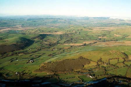
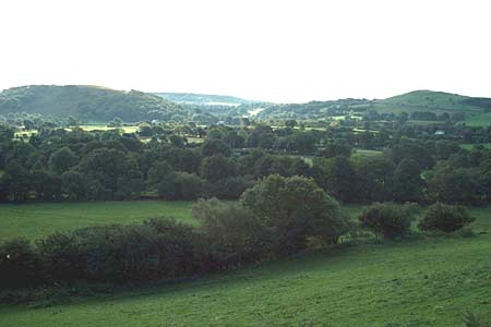
This area lies across the valley floors and partly up the lower valley sides of the Afon Groes, Afon Brennig, Afon Berwyn and Nant Fleinog between 175m and 200m. It comprises scattered farms set in a matrix of small, irregularly shaped fields. Boundaries consist of earth banks topped with hedges. Hedges are generally in good condition, though a few are no longer stock-proof and are reinforced with wire fences. There are many distinctive trees on the boundaries; these together with the scattering of small woods across the area give an impression of a moderately wooded landscape. Farmland is mainly improved pasture, though there is some unimproved pasture, rough grazing and rushy - brwyn - ground.
Local stone is the traditional building material with slate (north Wales slate) used for roofs. Walls are either cement rendered or left bare on houses and always bare on traditional farm buildings. Older farmhouses/houses that date almost entirely to the mid-to-late 19th century, are relatively small, of two storeys and in the typical Georgian vernacular style – gable end chimneys, central front door, two windows either side of the door and one above. Vernacular traits such as low eaves, small windows and one chimney larger than the other are present on some houses. Stone-built outbuildings are generally confined to one or two small ranges, with some attached and in-line to the house. Several farms are not now working and their outbuildings are falling into disuse. Working farms have small ranges of modern steel and concrete agricultural buildings. Also in this area are a larger early 20th century house, a small listed 1866 chapel and a scatter of late 20th and early 21st century housing, mostly bungalows, with a concentration close to Tregaron on the eastern side of this area.
Recorded archaeology consists of just a few sites, and these are mainly post-Medieval extant dwellings, and other minor landscape components of similar date. A possible standing stone of Bronze Age date provides the only time-depth element to the area.
The boundaries of this area are not generally sharp. However, to the west the town of Tregaron provides clear definition, and to the north the steep valley side is also a distinct boundary.
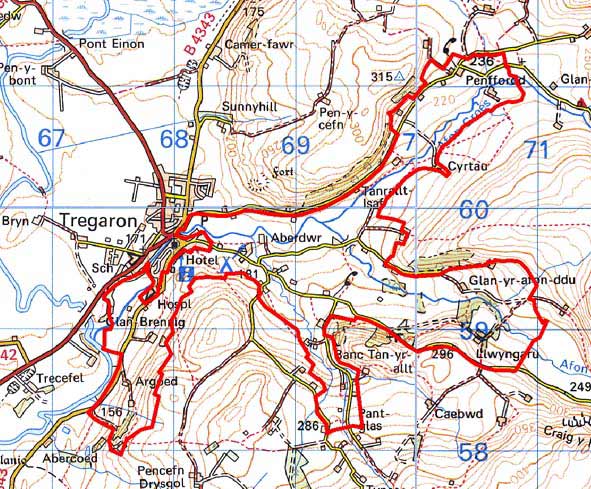
Base map reproduced from the OS map with the permission
of Ordnance Survey on behalf of The Controller of Her Majesty's Stationery
Office, © Crown Copyright 2001.
All rights reserved. Unauthorised reproduction infringes Crown Copyright
and may lead to prosecution or civil proceedings. Licence Number: GD272221