Home > Historic Landscapes > Black Mountain and Mynydd Myddfai > |

255 BLAEN CENNEN 
GRID REFERENCE: SN 686191
AREA IN HECTARES: 209.50
Historic Background
A narrow area on the lower northern slope of the Black Mountain. Evidence
of early settlement occurs in the limestone area around Llygan Llwchwr,
at the western end of this character area. Giving great time-depth to
the landscape, a possible neolithic chambered tomb has been recorded adjacent
to a prehistoric findspot, Bronze Age burnt mounds and an Iron Age/Romano-British
settlement. During the historic period the area lay within Cantref Bychan,
divided between two commutes. The western half lay within Iscennen commote,
which remained nominally independent of Anglo-Norman rule until 1284 when
it was acquired by John Giffard, and in 1340 it became a member of the
Duchy of Lancaster (Rees 1953, xv-xvi). The remainder of Cantref Bychan,
including Cwmwd Perfedd within which the eastern half of the area lay,
was invaded by the Anglo-Normans under Richard Fitz Pons who established
a caput at Llandovery in 1110-16 (Rees n.d.) and was acquired soon after
by the Clifford lords of Brecon as the Lordship of Llandovery. However,
there were many episodes of Welsh rule and the area retained native tenurial
customs until the end of the Medieval period when it was incorporated
into modern Carmarthenshire. The pattern of regular rectangular enclosures
with straight boundaries suggests that the area comprised unenclosed pasture
until the Post-Medieval period. Part of the area is recorded as formal
common land, but fields around Blaencennen Farm are more irregular and
it appears to be an earlier holding, while the physical boundary between
this area and the unenclosed moorland of Area 239 to the south is well-defined
as a masonry wall dating from the 16th century in places (Leighton 1997,
29). Early Post-Medieval hut platforms and pillow mounds have been recorded
at Llygad Llwchwr, in association with a small limestone quarry and kiln
site. Nevertheless, pastoralism was the mainstay of the economy and Cwmllwyd
sheepfold, at the eastern end of the area, which has recently been restored
(Murphy 1998), served several farms which gave their names to the enclosures
into which it was subdivided. There is a further sheepfold and a dip.
The landscape had assumed its present form by c.1840 (Llandeilo Fawr and
Llangadog tithe maps) and there has been little subsequent change or development.
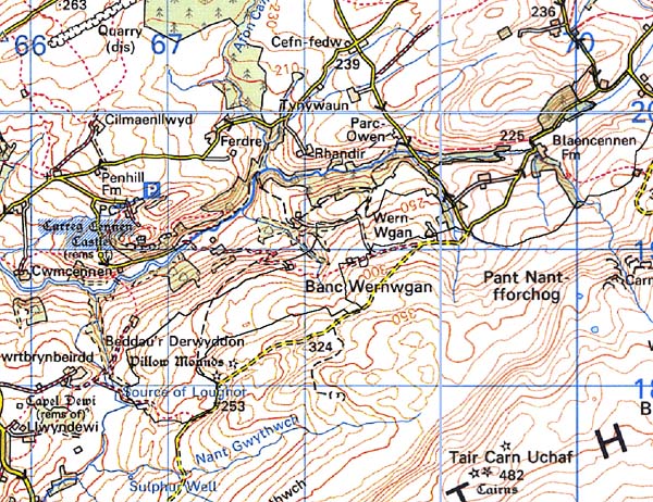
Base map reproduced from the OS map with
the permission of Ordnance Survey on behalf of The Controller of Her Majesty's
Stationery Office, © Crown Copyright 2001.
All rights reserved. Unauthorised reproduction infringes
Crown Copyright and may lead to prosecution or civil proceedings. Licence
Number: GD272221
Description and essential historic
landscape components
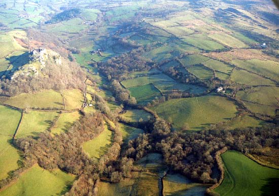
The relatively small character area lies on north-facing slopes between
the Cennen valley and the Black Mountain at heights of 220 m to 320 m.
The whole of the area is enclosed. Fields are a mixture of fairly small
regular and irregular enclosures which are interspersed with larger regular
enclosures. There is a variety of boundary types. A dry-stone wall lies
along the boundary with the Black Mountain, and other similar walls lie
at these higher elevations close to the Black Mountain. Most walls are
broken-down. Earth banks and/or stony banks are the other boundary types.
These were formerly topped with hedges, but nearly all the hedges have
now gone or are reduced to straggling lines of bushes. Wire fences provide
stock-proof boundaries. There are very few trees. Land-use is a mixture
of rough grazing, rushy, wet ground and improved pasture. Transport links
are local and consist of lanes and tracks. The settlement pattern is of
dispersed farms. Farmhouses are 19th century, two-storey, three-bayed
and stone-built in the vernacular tradition. Outbuildings are of a similar
date, stone built and generally of quite modest proportions. Often they
comprise a single range. Most farms have modern agricultural buildings.
Recorded archaeology is relatively rich and diverse for a small area, comprising a Neolithic chambered tomb, two Bronze Age burnt mounds and a possible round barrow, a prehistoric findspot, an Iron Age/Romano-British open settlement, a possible Medieval holy well, and early Post-Medieval hut platforms, pillow mounds, quarry and limekilns.
There are some distinctive buildings but none are listed.
To the south this area is very well-defined at its border with the Black Mountain. Elsewhere definition is less good, and there tends to be a zone of change rather than a hard-edged boundary between this area and it neighbours.