Home > Historic Landscapes > Black Mountain and Mynydd Myddfai > |

232 MYDDFAI 
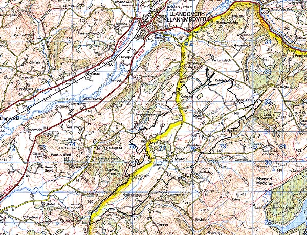
GRID REFERENCE: SN 774304
AREA IN HECTARES: 910.9
Historic Background
An area around, and including, the present village of Myddfai. It formed
the core of Maenor Myddfai, Cwmwd Perfedd, of the former Cantref Bychan
which was invaded by the Anglo-Normans under Richard Fitz Pons who established
a caput at Llandovery in 1110-16 (Rees n.d.). It was acquired soon after
by the Clifford lords of Brecon as the Lordship of Llandovery but reverted
to Welsh rule until 1282, and retained native tenurial customs until the
end of the Medieval period when it was incorporated within modern Carmarthenshire.
The village nucleus is represented by the parish church of St Michael
which appears to be the primary component, lying centrally in a circular
churchyard. The dedication may be pre-Conquest and the area is the site
of a lost ECM (Sambrook and Page 1995, 4), but the church is not mentioned
until 1284, when the advowson fell to King Edward I to be subsequently
granted to the Bishop of St Davids (Ludlow 1998). Talley Abbey also possessed
land around the village. In 1282 Maenor Myddfai, which may have been administered
from Myddfai itself, became the Manor of Myddfai under the Lord of Llandovery,
John Giffard (James n.d., 87). This event may be represented by the establishment
of the moated site just south of the present village, which in turn may
suggest that settlement around the church had already taken place. The
manor, and the Lordship of Llandovery, were later held by the Audleys,
and in the Post-Medieval period by the Vaughans of Golden Grove and the
Earls of Cawdor (James n.d., 87). Of greater influence on the landscape
history, however, were the resident gentry families of Cwm Ydw, the Bowens,
resident since the 18th century (Jones 1987, 50) and Gorllwyn, home of
the Prices since the 17th century (Jones 1987, 86), and also the nearby
Cilgwyn Mansion and Llwynwormwood (Area 228). At any rate, the landscape
within Area 232 was undoubtedly settled by the 17th century and the present
pattern of medium-large enclosures was in place by 1840 (Myddfai tithe
map). Small-scale mineral extraction in the area is represented by a Post-Medieval
lead shaft, and a quarry. The village of Myddfai became a centre of droving
activity during the 18th century with at least two inns (Sambrook and
Page 1995, 23), and was sufficiently important - as the head of the parish
- by the late 19th-century, to feature two chapels, a school and a post
office. The present terraced housing was also constructed during the late
19th-century, replacing most of the earlier buildings. There has been
some limited 20th century development which includes a sewage works just
southeast of the village.
Base map reproduced from the OS map with
the permission of Ordnance Survey on behalf of The Controller of Her Majesty's
Stationery Office, © Crown Copyright 2001.
All rights reserved. Unauthorised reproduction infringes
Crown Copyright and may lead to prosecution or civil proceedings. Licence
Number: GD272221
Description and essential historic
landscape components
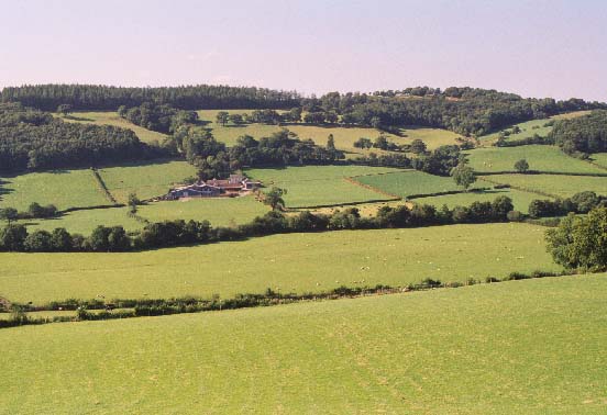
This character area is centred on the village of Myddfai which lies in
the open bowl-like valley of the Afon Brân. The valley floor lies at approximately
100 m to 130 m, the valley sides rise to over 200 m. Essentially this
is an area of dispersed farms and small fields. The whole landscape is
enclosed into small- and medium-sized fields that tend towards the regular
rather than the irregular. Boundaries are universally of earth banks topped
with hedges. Hedges are in good condition, but with some dereliction,
particularly at higher levels. Some hedges have distinctive hedgerow trees.
Wire fences supplement most hedges. Farmland is almost entirely improved
pasture. Small stands of deciduous woodland lie on some of the steeper
valley sides, but these are few compared with the highly wooded appearance
of neighbouring areas. The small nucleated village of Myddfai is centred
on the Medieval church of St Michael. Several terraces of late 18th- and
early 19th-century two-storey, stone-built (mostly rendered) cottages
cluster around the church, with a little later 19th- and 20th-century
residential development on the fringes of the village. Dispersed farms
are the main settlement type of the area. Farmhouses are mostly 19th century
in date, stone-built, two-storey, three-bays and generally in the vernacular
tradition. Most farms have 19th century stone-built farm buildings as
well as modern agricultural structures. The older buildings tend to be
of one or two ranges, which are rarely arranged formally around a yard.
The recorded archaeology is from many periods and comprises a Bronze Age hoard, standing stone and ?round barrow, a lost ECM site from the early Medieval period, the church, a post-Conquest moated site, and a lead mine and quarry from the Post-Medieval period. In addition are an unknown earthwork and cropmark site.
There are some distinctive buildings but few are listed. The landmark Medieval church, without a tower, is Grade B listed. A K6 telephone box in centre of the village is Grade II listed. There are a number of gentry houses including Llwynmeredydd, Cwm Ydw and Gorllwyn, rebuilt in the 18th- and 19th-century. The area also contains four chapels, a school, a public houses, post office and bridge.
Myddfai is not an easy character area to define as neighbouring areas possess similar historic landscape components. However, it does have a more regular field pattern than its neighbours, is less wooded, and has a small nucleated village at its core.