Home > Historic Landscapes > Black Mountain and Mynydd Myddfai > |

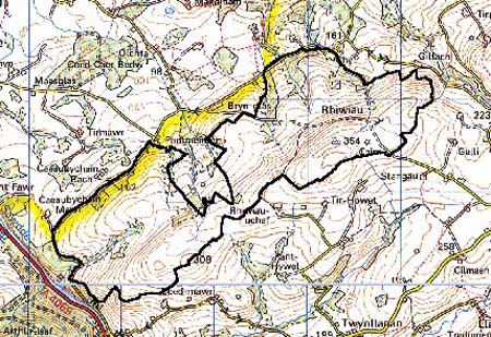
229 RHIWIAU 
GRID REFERENCE: SN 742261
AREA IN HECTARES: 406.40
Historic Background
A small character area on the northwestern flank of the Black Mountain.
It once formed part of Cwmwd Perfedd of the former Cantref Bychan which
was invaded by the Anglo-Normans under Richard Fitz Pons who established
a caput at Llandovery in 1110-16 (Rees n.d.). It was acquired soon after
by the Clifford lords of Brecon as the Lordship of Llandovery but retained
native tenurial customs until the end of the Medieval period when it was
incorporated within modern Carmarthenshire. The area lay in the further
division of Maenor Llanddeusant, which may have been coterminous with
the ecclesiastical parish of Llanddeusant. There is at present no settlement
which may reflect the general situation at least within the historic period,
when the area probably comprised unenclosed pasture. The present pattern
of large, rectangular enclosures was in place by 1841 (Llanddeusant tithe
map) but was probably the result of a fairly recent process possibly undertaken
by one of the larger local landowners. The presence of a possible sheepfold
suggests that the former landscape was unenclosed and pastoral. Evidence
for earlier settlement, and time-depth, is provided by two Bronze Age
round barrows. Small-scale mining activity is represented by Rhiw, a small,
Post-Medieval lead shaft in the north of the area. There has been little
recent development.
Base map reproduced from the OS map with
the permission of Ordnance Survey on behalf of The Controller of Her Majesty's
Stationery Office, © Crown Copyright 2001.
All rights reserved. Unauthorised reproduction infringes
Crown Copyright and may lead to prosecution or civil proceedings. Licence
Number: GD272221
Description and essential historic
landscape components
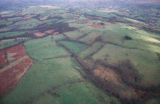
Rhiwiau character area lies across a southwest-northeast ridge which achieves
heights of over 350m. There are no settlements. The ridge has been divided
into medium- to large-sized fairly regular enclosures by earth banks and
hedges. On the ridge crest these enclosures are now mostly redundant;
the hedges have gone, and apart from wire fences it is an open area. On
the flanks of the ridge hedges consist of straggling lines of overgrown
bushes with occasional distinctive trees. Again wire fences provide stock-proof
boundaries. The whole area is improved pasture with a little rough grazing
on the highest areas and some steep slopes, and scrubby deciduous woodland
on the steepest slopes. Because of the dereliction of the old boundaries,
the ridge crest of Rhiwiau has an open unenclosed appearance.
Recorded archaeology comprises to Bronze Age round barrows, two llan place-names, Rhiw Post-Medieval lead mine, and a possible sheepfold.
There are no standing buildings.
Although Rhiwiau is a distinctive character area its boundaries are not hard-edged. There is a merging of this area with the neighbouring areas of enclosed farmland. Only to the west against a forestry plantation is there a distinct boundary.