|

222 CARN GOCH 
GRID REFERENCE: SN 690245
AREA IN HECTARES: 129.70
Historic Background
A small area southeast of the Tywi dominated by Carn Goch, a craggy hill
on which lie the substantial remains of Carmarthenshire's largest Iron
Age hillfort. At 15 ha, and associated with a satellite fort, Carn Goch
fort may have approached oppidum status and have been the centre of a
large territory taking in most of the area south of the Tywi. There is
evidence for earlier occupation of the site, possibly into the Neolithic,
and the significance of the site may have persisted after its abandonment
under Roman rule - the most plausible villa site in southwest Wales, Llys
Brychan (Jarrett 1962), lies only 1.6 km to the northeast (Area 225).
During the historic period the area lay within Cwmwd Perfedd, specifically
Maenor Vabon, of Cantref Bychan, which was, with the exception of Iscennen,
invaded by the Anglo-Normans advancing from the east under Richard Fitz
Pons who established a caput at Llandovery in 1110-16 (Rees n.d.). It
was acquired soon after by the Clifford lords of Brecon as the Lordship
of Llandovery. However, there were many episodes of Welsh rule and the
area retained native tenurial customs until the end of the Medieval period
when it was incorporated into modern Carmarthenshire. There is currently
no evidence for the continued occupation of the hillfort(s) and the area
appears to have been open common land during the Medieval period and into
the Post-Medieval period; however it contains the remains of longhuts
and associated enclosures, which are characteristic of early Post-Medieval
settlement in upland southwest Wales (Sambrook and Ramsey 199). Such settlement
may represent squatting, however, and there appears to have been little
subsequent settlement; apart from some 18th- and early 19th-century encroachments
along the northern fringe, the area is still largely unenclosed, as it
is on historic maps.
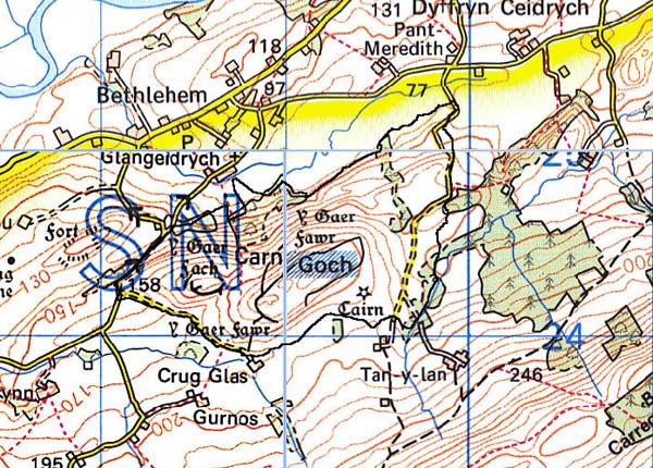
Base map reproduced from the OS map with the permission
of Ordnance Survey on behalf of The Controller of Her Majesty's Stationery
Office, © Crown Copyright 2001.
All rights reserved. Unauthorised reproduction infringes Crown Copyright
and may lead to prosecution or civil proceedings. Licence Number: GD272221
Description and essential historic landscape components
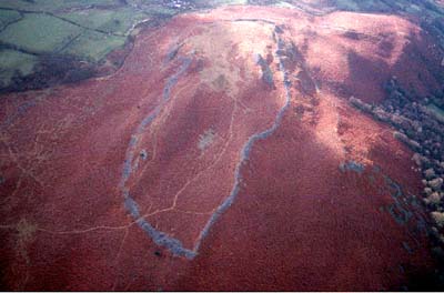
Carn Goch is a rounded bracken-covered hill on the south side of
the Tywi valley. From the floor of the Nant Geidrych valley on the north
at approximately 100 m, craggy scree slopes rise to over 230m. Southern,
western and northern flanks have less elevation, and are less precipitous
and less craggy. Parts of the more gently-sloping northeastern slopes
were formerly enclosed by earth banks and dry-stone walls, associated
with the longhuts, but these have broken down. Recent land improvement
has taken place in the area of old enclosures. The major defining historic
landscape element of this character area are the remains of Carn Goch
Iron Age fort and satellite fort. The remains are massive, and comprise
rubble-built ramparts, several metres high and many hundreds of metres
in length.
The recorded archaeology is dominated by the Iron Age hillfort and its satellite fort represented by ramparts, ditches and hut platforms. Earlier occupation is suggested by Bronze Age finds, a round barrow and a possible burnt mound, as well as a possible Neolithic site. There are also early Post-Medieval longhuts and field systems. Most of these sites are scheduled.
There are no standing buildings.
Carn Goch character area is very distinctive and stands in sharp contrast with the surrounding enclosed farmland.