|

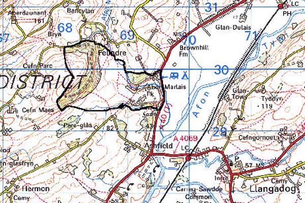
209 ABERMARLAIS 
GRID REFERENCE: SN 687298
AREA IN HECTARES: 128.60
Historic Background
A small area northwest of the Tywi floodplain corresponding to the former park and demesne of Abermarlais house. The area once lay within the Medieval Cwmwd Maenordeilo, held of the independent Welsh lordship of Cantref Mawr until the establishment of the county of Carmarthen in 1284. A high-status dwelling may have been established at Abermarlais as early as the 14th century (Rees 1932), when it was the residence of Sir Rhys ap Gruffydd who commanded the Welsh at Crécy (Jones 1987, 4). During the early 16th-century it was occupied by the great Tudor magnate Sir Rhys ap Thomas (ibid.) and upon his death it was inherited by his grandson, another Sir Rhys ap Gruffydd. He was executed by Henry VIII for treason and the estate, and the neighbouring 'lordship of Llansadwrn', fell to the crown (Sambrook and Page 1995, 21). Abermarlais was the subject of a laudatory poem by Lewis Glyn Cothi and was described by Leland in the 1530s as 'a well favorid stone place' (Smith 1906), which may have been semi-fortified but having been 'new mendid and augmentid' by Sir Rhys ap Thomas (Jones 1987, 4). Abermarlais was regarded as a manor, was recorded as the site of an annual fair by George Owen in 1601 (Sambrook and Page 1995, 22) and in 1670 was assessed for 21 hearths (Jones 1987, 4), all suggesting that the house may have been accompanied by some form of manorial settlement. It was later abandoned, and hut platforms and pillow mounds of probable Medieval date lie northwest of the house site. Alterations were made to the house during succeeding centuries when its surroundings were emparked. The Roman road from Carmarthen to Llandovery passed through the character area but appears to have become disused by the Medieval period and is not followed by any of the estate boundaries. During this period, and until the Roman road line was turnpiked in the 18th century (to become the present A40(T)), the routeway from Llandeilo to Llandovery ran along the higher ground through the centre of this character area (Ludlow 1999, 24). The old mansion was demolished in 1803 and replaced with a new house, itself demolished in the 1970s. Part of the estate is now a caravan park.
Base map reproduced from the OS map with the permission
of Ordnance Survey on behalf of The Controller of Her Majesty's Stationery
Office, © Crown Copyright 2001.
All rights reserved. Unauthorised reproduction infringes Crown Copyright
and may lead to prosecution or civil proceedings. Licence Number: GD272221
Description and essential historic landscape components
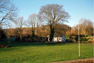
This relatively small character area is based on the former demesne and park of Abermarlais. It runs from the flood plain of the Tywi at approximately 40 m up the northern valley side to a maximum of just over 180 m. Abermarlais House is now demolished and the park and garden are decayed, but part of the estate boundary wall survives and also sufficient parkland character to warrant the separation of Abermarlais into its own character area. Although the area is partly divided into large enclosures by banks topped with hedges, the area has a open character, as many of the hedges are derelict and wire fences now provides the main divisor. Deciduous woodland surrounds the site of the former house, and at higher levels a 20th century conifer plantation has recently been clear-felled. In between these two woodland areas, improved pasture and rough grazing is the main land-use. The walled garden close to the former house survives; it is now the site of a touring caravan park. At least one lodge survives in a much modified condition.
Much of the recorded archaeology relates to the house and park and includes an ornamental garden, but hut platforms and pillow mounds of possible Medieval date have been recorded. In addition there is a Bronze Age standing stone and an unknown cropmark site, while a second similar site has been proposed as the site of a Roman fortlet, lying in association with the Roman road line.
Surviving buildings include a lodge and a bridge.
It is not now easy to distinguish the former park of this area from the neighbouring areas of dispersed farms and irregular fields. There are sufficient differences, however, to justify the separation of this area.