Home > Historic Landscape Characterisation > Carmarthen Bay Estuary Area > |

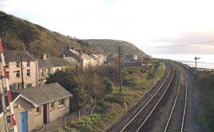 FERRYSIDE
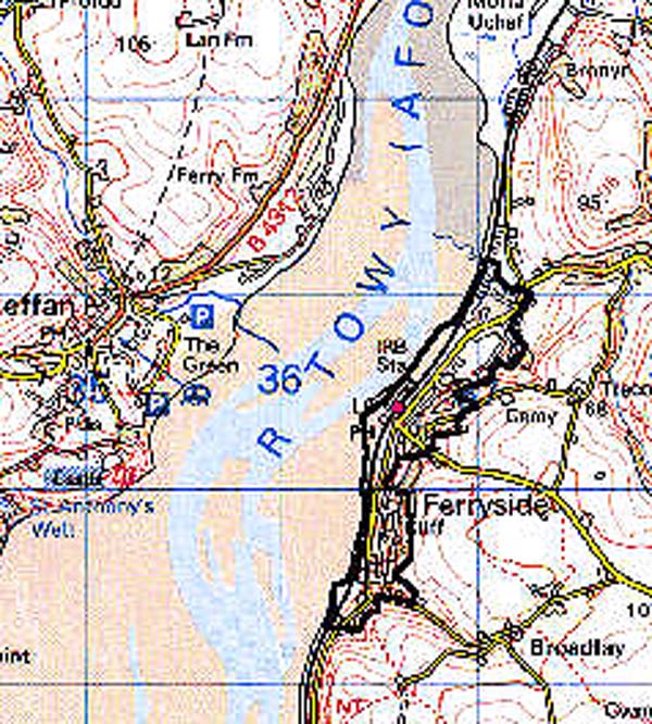
GRID REFERENCE: SN 367102
AREA IN HECTARES: 56.69
Historic Background
The area now occupied by the settlement of Ferryside formed part of the Medieval holding of St Ishmael which was a foreignry of Kidwelly Lordship and, tenurially, was an Englishry centred upon the demesne manor of St Ishmael (Rees 1953, 175-212); it also belongs within St Ishmael parish. The settlement developed around the landing stage of a ferry across the Tywi estuary, to Llansteffan, which may have pre-Conquest origins (Davies 1989, 27). It is mentioned as early as c.1170 when it was granted to the Knights Hospitaller at Slebech Commandery (see Area 141), and was crossed 'in a boat' by Gerald of Wales two decades later (Thorpe 1978, 138). The main Kidwelly-Ferryside road follows the line of a ?Medieval routeway called the 'Ferry Way', which led to the ferry from Kidwelly. Ferryside is the possible site of a Medieval chapelry dedicated to St Leonard (Rees 1932), and a fish-weir, both of which belonged to Whitland Abbey (Rees 1953, 208). A settlement may have developed here during the Medieval period. There is an 18th century dwelling (Grade II listed) within a village that is shown on the St Ishmael tithe map of 1840 as a cluster of dwellings around the ferry, with some straggling development along the foreshore. The direction of the GWR West Wales main line through the village in 1852 (Ludlow 1999, 28), with the establishment of a station, initiated a new wave of development, and in the 20th century Ferryside has become regarded as a desirable place to live, chiefly for its fine views across the estuary to Llansteffan Castle.
Base map reproduced from the OS map with the permission
of Ordnance Survey on behalf of The Controller of Her Majesty's Stationery
Office, © Crown Copyright 2001.
All rights reserved. Unauthorised reproduction infringes Crown Copyright
and may lead to prosecution or civil proceedings. Licence Number: GD272221
 Description and essential historic landscape components
The built-up area of Ferryside which lies between just above sea level and 50 m (at its highest point), on the eastern shore of the Tywi estuary. It comprises ribbon development along the north-south road parallel with the railway line, which has mostly occurred since 1859; there are terraces from c.1900 and much 20th century building. Housing is mainly to the north of the station, development along both the Kidwelly road, and the road to St Ishmaels, having been limited by the steepness of the hillslope.
Recorded archaeology is mainly in the form of buildings but, in addition to the ferry site and possible lost chapel site noted above, also includes finds of prehistoric date from Cockle Rock in the far south of the area.
Most buildings are 19th- and 20th-century, are in a mixture of stone and brick, rendered concrete, and other materials with slate and concrete tile roofs. However, there is an 18th century dwelling which is a Grade II listed building, and St Thomas' Church which was established in the early 20th-century (not listed). In addition are a lifeboat station, the railway line and station, and a former brickworks.
This historic landscape area lies between High Water Mark and the agricultural land to the east.
Recorded archaeology in the area consists only of those features noted above ie. Kymer's quay and canal, the railways, the former brick- and silica works, and the sea-defences. Kymer's quay has been restored and there are some associated stone buildings, now derelict.
There are no distinctive buildings.
This is a distinct historic landscape area of sand hills and marsh, lying between unenclosed muddy saltmarsh and the rising, bank-enclosed ground to the north.