Base maps reproduced from the OS map with the permission
of Ordnance Survey on behalf of The Controller of Her Majesty's Stationery
Office, © Crown Copyright 2001. All rights reserved. Unauthorised reproduction
infringes Crown Copyright and may ead to prosecution or civil proceedings.
Licence Number: GD272221
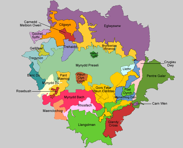
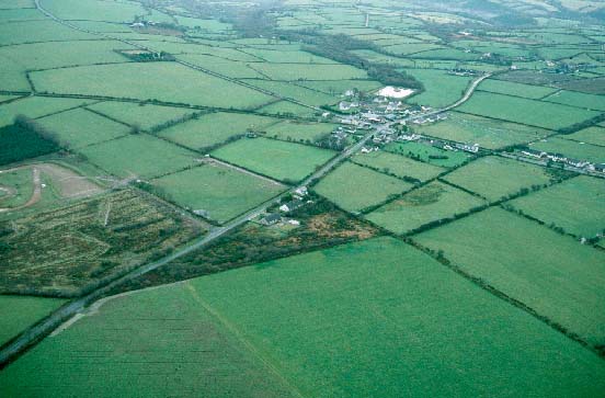
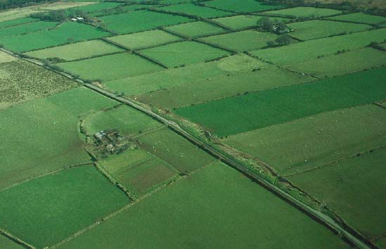
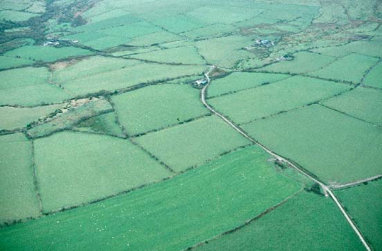
| 258 Mynachlog-ddu
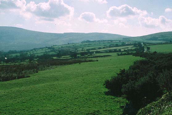
historic landscape character area lies on the southeastern side
of Mynydd Preseli and consists of dispersed farms set in a landscape
of small irregular fields. The area is centred on the loose agglomeration
of houses that make up the hamlet of Mynachlog-ddu. Stone is the
principal building material, though brick, concrete and corrugated
iron are also present. Field boundaries are of earth or earth and
stone topped with hedges. Land-use is predominantly improved pasture
with pockets of rougher land. |
|
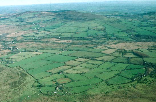
| 259 Gors
Fawr - Waun Cleddau historic landscape character area consists
of poor quality unenclosed land on the valley floor of the upper
Eastern Cleddau and its tributaries, at the foot of Mynydd Preseli.
Almost all the area is given over to rough grazing, and includes
peaty and boggy hollows. Gors Fawr stone circle is situated in this
area. |
|
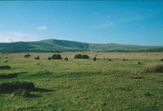
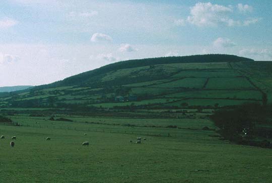
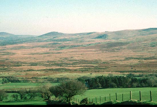
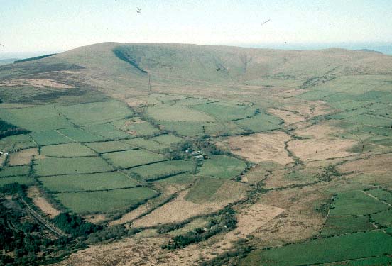
| 260 Foel
Dyrch historic landscape character area is an outlying hill
of Mynydd Preseli. It is unenclosed land entirely given over to
rough grazing. There are no inhabited settlements, though deserted
farms are a feature of the landscape. An abandoned quarry is a prominent
landscape element. |
|
| 261 Llethr
historic landscape character area comprises fields and
farms on the southeastern slopes of Mynydd Preseli. Buildings are
mostly stone-built and of 19th century date. A distinctive characteristic
of the landscape is the use of dry-stone walls as field boundaries.
20th century coniferous forestry has been planted across abandoned
fields and farms on the higher slopes. |
|
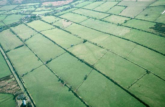
262
Pentre Galar historic landscape character area was open common
land until it was enclosed by Act of Parliament in 1812. The regular
field system, dispersed farms and roads all date to this period.
Stone is the principal building material. Boundaries are of earth
banks topped with hedges. Land-use is improved pasture with tracts
of rougher ground. |
|
263
Carn Wen historic landscape character area consists of a small
unenclosed hill of scrubby land. The remains of a quarry abandoned
in the late 20th-century are a prominent landscape element. There
are no settlements, trees or roads in this area. |
|
264
Crugiau Dwy historic landscape character area lies along the
crest of a ridge on the southeastern side of Mynydd Preseli. It
is divided into large fields by wire fences, but apart from improved
pasture at the northern end, rough grazing is the predominant land-use.
There are no settlements or roads, and, other than a small coniferous
plantation, it is virtually a treeless landscape. |
|
|
265 Glandy Cross historic landscape character area is
centred on the A478 road. A system of fairly regular fields with
dispersed farms and cottages lies either side of this road. Late
20th-century linear housing and other buildings have developed at
Glandy Cross and Efailwen. Prehistoric ritual and funerary monuments,
including Meini Gwyr stone circle, are a characteristic of this
area. |
|
266
Llangolman historic landscape character area consists of irregular
fields, dispersed farms and cottages, narrow lanes and woodland
on steep valley sides. Buildings are of varied character and range
from large farmhouses through to single storey cottages. Stone is
the traditional building material. Boundaries are of earth or earth
and stone, and are topped with hedges. Pasture is the predominant
agricultural land-use. |
|
267
Rhosfach historic landscape character area lies on the southern
slopes of Mynydd Preseli. It comprises small fields of pasture and
rough ground, and small pockets of common. The settlement pattern
is of dispersed farms and cottages. Stone-built, single-storey,
19th century cottages are characteristic of this area. There are
few trees, apart from those in overgrown hedges on the earth- or
stone-boundary banks. |
|
268
Maenclochog historic landscape character area is centred on
the village of Maenclochog. This is a planned village with houses,
farms, shops, public houses and chapels set around a rectangular
village green on which the church is located. Most buildings date
to the 19th- and 20th-century. Stone is the traditional building
material. Long narrow fields of an enclosed strip-field system surround
the village. Agricultural land-use is predominantly pasture. |
|
269 Mynydd Bach historic landscape character area was
enclosed by Act of Parliament in 1815. A regular field system, dwellings
and roads were established at this date upon what had previously
been open common land. Dispersed stone-built farms and cottages
form the main settlement types. Apart from 20th century coniferous
plantations, the main land-use is pasture with tracts of rough land.
Wide straight roads are characteristic of this area. |
|
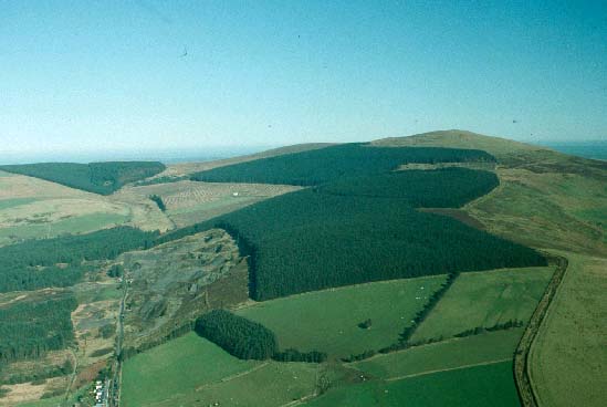
270 Pant Maenog historic landscape character area consists
entirely of a large 20th century coniferous plantation. This has
been established partly over abandoned fields and farms which originated
in an Act of Parliament of 1815 and partly over open land of Mynydd
Preseli. |
|
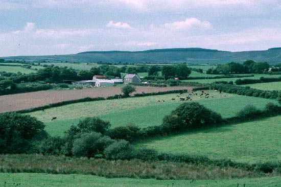
271 Mynydd-du historic landscape character area
lies in a sheltered valley on the southwestern slopes of Mynydd
Preseli. It consists of scattered farms surrounded by small fields,
with larger fields on higher slopes. Stone is the traditional building
material. Hedges on the earth- or earth and stone-banks have now
gone, and the landscape has a very open aspect, with very few trees.
Improved pasture with tracts of rough wet ground is the predominant
land-use. |
|
272 Banc Du historic landscape character area consists of
semi-enclosed improved pasture on the southwestern flanks of Mynydd
Preseli. Hedges on the boundary banks have long gone and the absence
of trees lends an open aspect to the landscape. There are no inhabited
dwellings. |
|
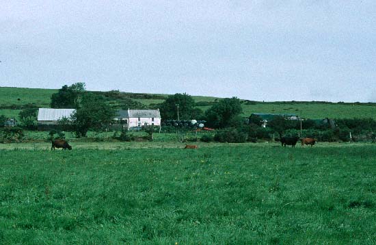
273 Tregynon historic landscape character area lies
on the northwestern flanks of Mynydd Preseli and is characterised
by small- and medium-sized fields and dispersed farms. Stone is
the traditional building material. Apart from alongside lanes and
tracks, hedges on the boundary banks are absent. It is virtually
a treeless landscape. Improved pasture is the main agricultural
land-use |
|
274 Gellifawr historic landscape character area
lies across a shallow valley on the northwestern flanks of Mynydd
Preseli. It comprises small, irregular fields surrounded by earth
and stone banks topped with hedges, and dispersed farms. Two relatively
large farms are present. Stone is the traditional building material.
Land-use is a mixture of improved pasture, arable and rough grazing
|
|
275 Cilgwyn historic landscape character area lies in an
undulating hollow on the north side on Mynydd Preseli and consists
of small, irregular fields, small farms, cottages, religious buildings,
winding lanes and small woods. Overgrown hedges on stony banks lend
a very wooded aspect to the landscape. Stone is the traditional
building material. Agricultural land-use is predominantly improved
pasture with some rougher ground. |
|
276 Gochel Sythi historic landscape character area lies
on the southern side of Mynydd Carningli and consists of small irregular
fields and deserted farms. Both the farms and fields probably originated
in the 18th- or 19th-century. At higher levels fields are reverting
to moorland, but improved pasture is present at lower levels. |
|
| 277
Trehaidd historic landscape character area consists of fairly
regularly-shaped fields and dispersed farms, cottages and houses.
The dwellings vary in style, building material and date, but generally
they belong to the 19th- and 20th-century. Hedges on the earth-
or earth and stone-boundary banks are not well maintained. Improved
pasture is the main land-use, with some rougher ground and a little
arable. |
|
| 278
Carnedd Meibion-Owen historic landscape character area consists
of open moorland with improved land at its southeastern side. There
are no inhabited houses. |
|
| 279
Brynberian - Mirianog historic landscape character area lies
along the northern fringe of Mynydd Preseli and consists of small,
irregular fields, dispersed farms and cottages and winding lanes.
Stone is the traditional building material. Boundary banks are stony
and topped with hedges. Land-use is mostly improved pasture, but
with pockets of rough, wet ground. |
|
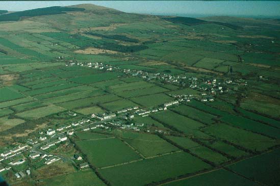
| 280
Eglwyswrw historic landscape character area lies across a rolling
hilly landscape to the north of Mynydd Preseli and consists of rich
pasture-land divided into medium-size fields, dispersed dwellings,
religious buildings and small villages. Stone is the tradition building
material, but modern materials are also used. Field boundaries are
of earth and topped with hedges. The two villages of Felindre Farchog
and Eglwyswrw lie on the main A487(T) road which crosses this area.
|
|
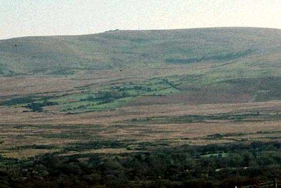
| 281
Mynydd Preseli historic landscape character area comprises a
large tract of unenclosed moorland. Though there are no inhabited
dwellings in the area, sites of past human activity are numerous
and range from prehistoric ritual and funerary monuments, hillforts
- in particular Y Foel Drygarn - to deserted medieval and post-medieval
settlements. |
|
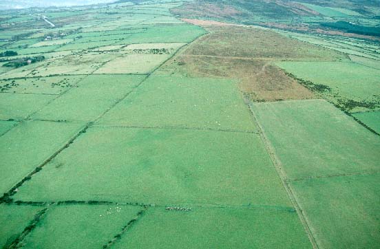
| 282
Hafod Tydfil historic landscape character area consists of a
small island of enclosed pasture on Mynydd Preseli. The farmstead
is demolished and the hedges on boundary banks are becoming overgrown.
|
|
| 283
Waun Clyn Coch historic landscape character area comprises fields
and abandoned farms lying in a sheltered hollow on the southern
slopes of Mynydd Preseli. The farms and fields were not established
until after 1840. Hedges are now absent on the boundary banks, and
the whole area has an open aspect. Land-use is mostly improved pasture,
with pockets of rough, wet ground. |
|
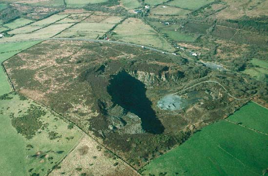
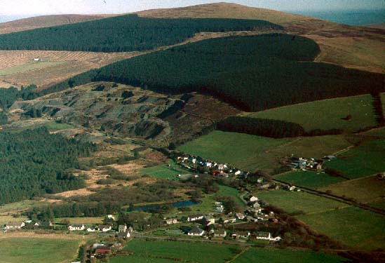
| 284
Rosebush historic landscape character area is an industrial
landscape characterised by quarry workings, workers houses and old
infrastructure elements such as a disused railway. |
|