Home > Historic Landscape Characterisation > Upland Ceredigion > |

 PEN-Y-GRAIG
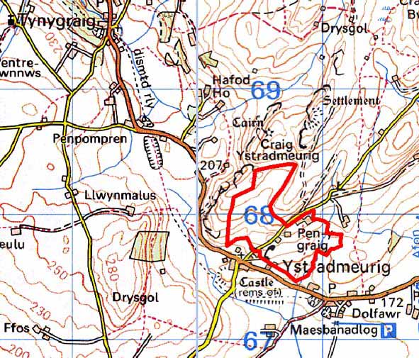
GRID REFERENCE: SN 708679
AREA IN HECTARES: 39.4
Historic Background
The early history of this area has not been researched. The church of St John the Baptist at Ystrad Meurig was granted to the Knights Hospitaller in 1158 (Ludlow 1998). There is also a possible hospice site at Mynachdy, perhaps indicating that land was also included in the grant. However, this place-name may refer to the site being used by the monks of Strata Florida Abbey - this part of the area may have lain within the grange of Mefenydd. Later tenurial systems and landscape developments are unknown until the 19th century. The tithe map (Spytty Ystrad Meurig Tithe Map and Apportionment, 1843) shows that the modern settlement pattern and field system was established by 1843. Some sub-division of the larger fields has occurred since then, but nothing on a scale to alter the established pattern.
Description and essential historic landscape components
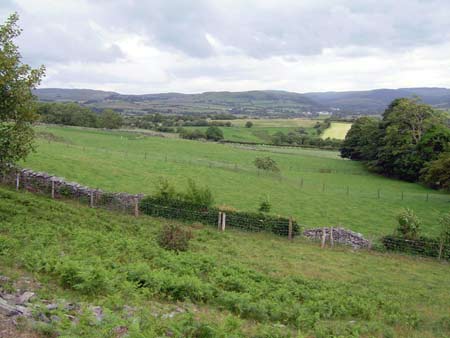
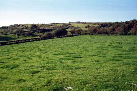
This small landscape area lies on gently sloping, southwest facing ground above and to the east of Ystradmeurig village. It ranges in height from 190m in the south to 230m in the northeast. Although a small area it is distinct from surrounding areas and is characterised by small enclosures separated by dry-stone walls and other boundary types. The majority of boundaries are dry-stone walls, which are generally in good condition, but are falling into disuse and decay in the northern part of the area. Earth banks topped with hedges and wire fences are other types of boundary. Improved grazing dominates this area.
Settlement consists of a few dispersed farms. Older buildings probably date to the mid-to- late 19th century, and are built of stone which is typically cement rendered or left bare on houses and left bare on outbuildings. Houses are of two storeys and in the regional Georgian vernacular style – gable end chimneys, central front door, and two windows either side of the door and one above. A modern house is located here, and one of the farmhouses is extensively modernised. Nineteenth century farm outbuildings are generally small and of one or two ranges. Farms have small to medium sized modern steel and concrete agricultural buildings.
Bounded by high, unenclosed land or large enclosures,
this area is well defined to the north. On its southern side it merges
with the neighbouring area - an area of small enclosures separated by
earth banks and hedges.
Base map reproduced from the OS map with the permission
of Ordnance Survey on behalf of The Controller of Her Majesty's Stationery
Office, © Crown Copyright 2001.
All rights reserved. Unauthorised reproduction infringes Crown Copyright
and may lead to prosecution or civil proceedings. Licence Number: GD272221