Home > Historic Landscape Characterisation > Upland Ceredigion > |

 GWAR CASTELL
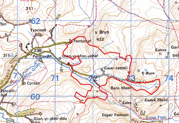
GRID REFERENCE: SN 724606
AREA IN HECTARES: 175.0
Historic Background
Historically this area seems to have been common land within Cwmwd Penardd, and was unenclosed, un-settled land until the late 18th century. An 1822 survey (Muckle and Williams 1992, 35) records squatter settlements at Bryn Lloi, Gwar Castell, Tan Bylchau, Waun Groes, Bryn Coch, Garnwen and Lluast Abercaeau. Rees (1936) records 11 tai unnos before 1839 and five after 1839 in the Blaencaron area. By the early 19th century further enclosures, mostly on higher land to the east of the area, had been added to those originally enclosed by the squatters. A school was established in 1883 and a chapel constructed to the east served the spiritual needs of the inhabitants. Only Gwar Castell is now occupied. Other cottages and farms were abandoned between World War One and World War Two. The area has now reverted to sheep-walk. Some of the deserted dwellings in this area are of interest; including a number of sub Medieval type houses, classified by Smith (1966, 1988) as type ‘B’ regional houses (main chimney backing on to entry), which continued to be built by poorer farmers into the 19th century.
Description and essential historic landscape components
This area consists of the valley head and surrounding valley sides of the Groes Fechan situated between 220m and 420m. The valley is steep-sided with a narrow flat-bottomed floor. This area was formerly enclosed with a system of irregular small- and medium-sized fields and a settlement pattern of dispersed farmsteads. The fields and settlements date to the late 18th and 19th century. Only Gwar Castell farm is still occupied, the others are now deserted and in varying stages of decay. Local stone is the building material. Dry-stone walls and stone-faced banks comprise the old-field boundaries - no hedges are present. Dry-stone walls are used to form small paddocks around the farmsteads. All of these old boundaries are now derelict and most are in an advanced state of disrepair. Wire fences now divide the area into large enclosures. Most of the land has reverted to rough grazing with much rush cover, and the derelict farmsteads are beginning to be submerged beneath rushes and bushes. There are peaty deposits in hollows and on the valley bottom. Improved grazing within large wire-fence enclosures has been created on dryer ground on the valley sides. There are some small stands of woodland and stunted trees in the yards of the deserted farms.
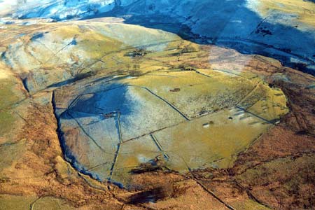
Apart from a possible Bronze Age standing stone and minor post-Medieval elements of the landscape, the recorded archaeology consists entirely of the abandoned settlements described above.
This is a well defined area. To the north, south and east lies unenclosed, unsettled land, and to the west is lower lying settled and farmed land.
Base map reproduced from the OS map with the permission
of Ordnance Survey on behalf of The Controller of Her Majesty's Stationery
Office, © Crown Copyright 2001.
All rights reserved. Unauthorised reproduction infringes Crown Copyright
and may lead to prosecution or civil proceedings. Licence Number: GD272221