|

 MANORBIER CAMP
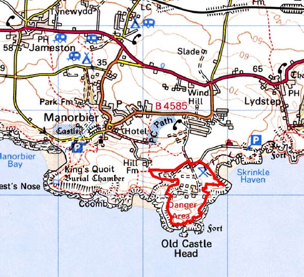
GRID REFERENCE: SS 075970
AREA IN HECTARES: 31
Historic Background
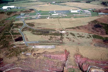
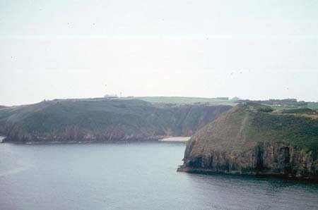
A small area of modern Pembrokeshire comprising the headland called Old Castle Head. Historically, the area formed part of the narrow coastal strip between Freshwater East and Lydstep, which was always marginal land, lying between cultivated land and the sea-cliffs. However, it is dominated by a prehistoric occupation site, an iron age promontory fort on the tip of Old Castle Head. The fort has traces of hut platforms within the main multivallate enclosure, with a less well-preserved annexe to the north. During the medieval period, the area lay within the Anglo-Norman manor of Manorbier (and Penally) which was a mesne lordship or honorial barony held, by the service of 5 knights, of the Lordship and Earldom of Pembroke, a heavily Anglicised region that was brought under Anglo-Norman control before 1100, re-organised along English manorial lines and never retaken by the Welsh. The barony had been held, since the very early 12th century, by the de Barris and, on their extinction in 1392, was sold to the Dukes of Exeter before reverting to the crown in 1461. From that point onwards it was leased to a succession of individuals before being settled on the Philippses of Picton Castle, with whom it remained until the 20th century. Within the historic period, land-use was mainly as rough grazing – possibly including sheep-grazing as three tenants of Manorbier vill possessed sheepcotes in the early 17th century. The name ‘Conigar Pit’ also indicates a former rabbit-warren. Late 18th century estate maps, and the tithe map, show the headland as one large enclosure named ‘Old Castle’, with a large field inland named ‘Open Ground’. Manorbier Camp was established on Old Castle Head as an anti-aircraft artillery school during World War 2, and features a number of structures and installations. It is still operational under the MoD.
Description and essential historic landscape components
The Ministry of Defence uses this very small historic landscape character area. It lies on a small promontory – Old Castle Head – at about 50m to 60m above sea level. The military camp was formerly more extensive, with installations stretching along cliff tops to the east, but is now confined to the promontory. Apart from the earthworks of Old Castle Head iron age fort and World War 2 military buildings, the landscape is characterised by large, modern military structures and roads separated by improved pasture.
The military camp distinguishes this area from the coastal strip to the west, south and east, and from farmland to the north.
Sources: Cadw 2001; King and Perks 1970; Manorbier Parish tithe map 1842; National Library of Wales NLW Vol 88; National Library of Wales Picton Map 11; Thomas 1994; Walker 1992
Base map reproduced from the OS map with the permission
of Ordnance Survey on behalf of The Controller of Her Majesty's Stationery
Office, © Crown Copyright 2001.
All rights reserved. Unauthorised reproduction infringes Crown Copyright
and may lead to prosecution or civil proceedings. Licence Number: GD272221