|

223 FFOREST 
GRID REFERENCE: SN 784402
AREA IN HECTARES: 463.50
Historic Background
An area in the foothills of the Cambrian Mountains east of the headwaters
of the River Tywi, once part of Cantref Bychan which was invaded by the
Anglo-Normans under Richard Fitz Pons who established a caput at Llandovery
in 1110-16 (Rees n.d.). It was acquired soon after by the Clifford lords
of Brecon as the Lordship of Llandovery, but retained native tenurial
customs until the end of the Medieval period when it was incorporated
within the modern Carmarthenshire. The northern half of the area lay within
the Manor of Nant-y-bai, which had been granted as a grange to the Cistercians
of Strata Florida, probably by Gruffydd ap Rhys in c.1200, and remained
together after the Dissolution as the Ystrad-ffin estate. A survey of
1629 (Carmarthenshire Record Office, Lort Muniments 17/678) shows that
it contained most of the surrounding farms, demonstrating that the surrounding
landscape was already settled. As an upland grange and manor, however,
it was probably operated by tenant farmers primarily concerned with the
mountain pasturing of animals. Area 223 is labelled 'Crugyblaidd Forest'
on Rees' map of 14th century South Wales (Rees 1932) and its boundary
morphology suggests that it remained largely unenclosed until the early
19th-century. A sheepfold in the northern part of the area may be earlier
and demonstrates that pasturing was undertaken. The area also contains
the remains of a house platform, and enclosures which may be associated,
which are characteristic of early Post-Medieval settlement in upland southwest
Wales (Sambrook and Ramsey 1995), and may represent squatting. Time-depth
is provided by a number of Bronze Age ritual sites. There has been no
recent development but there are pockets of later 20th century conifer
plantation.
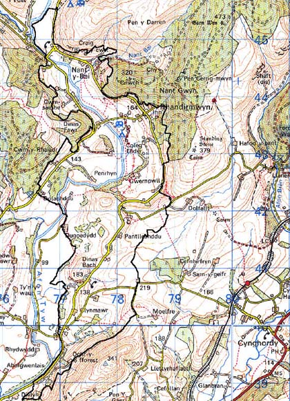
Base map reproduced from the OS map with the permission
of Ordnance Survey on behalf of The Controller of Her Majesty's Stationery
Office, © Crown Copyright 2001.
All rights reserved. Unauthorised reproduction infringes Crown Copyright
and may lead to prosecution or civil proceedings. Licence Number: GD272221
Description and essential historic landscape components
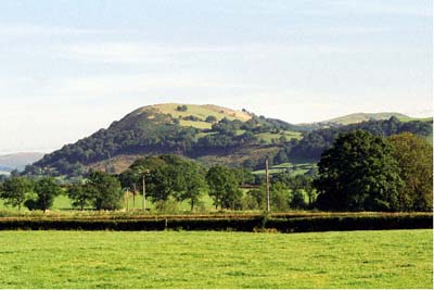
Fforest character area occupies the crest of a 6 km long ridge which
lies between the valleys of the Afon Tywi and Afon Brân. The ridge rarely
achieves heights of over 300 m. Its northern, southern and western flanks
fall away steeply to the valley floors. To the northeast the ridge rises
to unenclosed upland. There are no settlements in the area. Earth banks
divide the ridge into fields. At the highest levels and on steep slopes
the fields are large; the banks are redundant and wire fences provide
stock-proof boundaries. Essentially at these highest levels the area is
open moorland. Steep slopes are cloaked with scrubby woodland and bracken.
At lower, sheltered locations on the ridge crest, and on the less steep
flanks, fields are small and defined by earth banks with hedges. Hedges
are in poor condition; either derelict or overgrown. Wire fences again
provide stock-proof boundaries. Bushes in some of the very overgrown hedges
have developed into distinctive hedgerow trees. Land-use in these areas
is a mixture of improved grazing and rough pasture. There are one or two
small conifer plantations present.
Recorded archaeology provides time-depth and comprises two round barrows, one possible barrow, and a findspot all from the Bronze Age, at least one Iron Age hillfort, and a second suggested by a cropmark, a Post-Medieval house platform and possible cockpit, and an undated field system
Built structures are represented only by a sheepfold and sheep-dip.
Fforest is a distinctive character area and contrasts with lower-lying, settled and enclosed land which surrounds it.