|

219 CRAIG DDU 
GRID REFERENCE: SN 752471
AREA IN HECTARES: 695.70
Historic Background
A small area in the foothills of the Cambrian Mountains, lying within
the former Cwmwd Malláen of Cantref Mawr which remained an independent
Welsh lordship until 1284 and largely retained native systems of tenure
throughout the medieval period; it also lies within the ecclesiastical
parish of Cilycwm. It may have formed part of Nant-y-bai grange/Ystrad-ffin
Manor, an ownership from which the name Allt Maesymeddygon on the eastern
flanks of the area may be derived. As an upland grange, Nant-y-bai was
probably operated by tenant farmers primarily concerned with the mountain
pasturing of animals, and appears to have been largely unenclosed during
the historic period, as it is today, and is depicted as open pasture on
the earliest historic maps. Physical evidence for former enclosure exists,
however, and there are relict field systems from both the Bronze Age and
the earlier Post-Medieval period, the latter in association with the longhut/longhouse
characteristic of upland settlement in southwest Wales during this transitional
period (Sambrook and Ramsey, 1999). The area has no recent settlement,
but the dam for Llyn Brianne reservoir, constructed at the northern edge
of the area during the 1960s, has had a profound effect on the landscape.
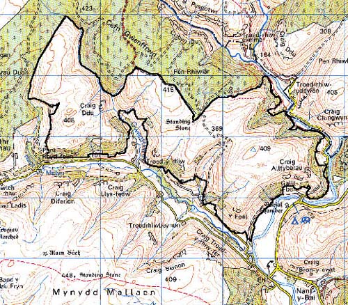
Base map reproduced from the OS map with the permission
of Ordnance Survey on behalf of The Controller of Her Majesty's Stationery
Office, © Crown Copyright 2001.
All rights reserved. Unauthorised reproduction infringes Crown Copyright
and may lead to prosecution or civil proceedings. Licence Number: GD272221
Description and essential historic landscape components
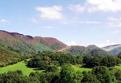
Craig Ddu character area consists of open moorland. It lies between
the upper Tywi and upper Gwenffrwd valleys. Steep, craggy valley sides
of these two rivers form the eastern and southern boundaries of this area.
The valley sides rise from approximately 130 m to over 350 m. The remainder
the area comprises an undulating plateau between 350 m and 420 m. Apart
from ancient deciduous woodland on some of the valley sides, and occasional
wire fences, this area is entirely rough, open moorland with peat deposits
in high hollows.
Recorded archaeology represents considerable time-depth, comprising a Bronze Age standing stone, a possible prehistoric field system, and a longhut/longhouse and field system from the earlier Post-Medieval period
There are virtually no standing buildings and none are distinctive; however, the late 20th-century Llyn Brianne dam deserves note
This area is well defined by farmland in the valley bottoms and by a conifer plantation to the north.