Home > Historic Landscape Characterisation > Carmarthen Bay Estuary Area > |

 PENBRE SALTMARSH

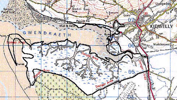
GRID REFERENCE: SN 384054
AREA IN HECTARES: 641.20
Historic Background
An area of saltmarsh on both sides of the Gwendraeth estuary. The southern side has mainly developed since the construction of Banc-y-lord, the great sea-wall which forms the southern edge of the area, in 1817-18 (James 1991, 156-7). The northward side of the estuary has been subject to erosion rather than deposition, but this area featured a quay, Berwyn (or 'Ballast') Quay, until the mid 19th century (Morris 1988, 77). A quay was established at Pill Tywyn at the end of Ashburnham's Canal, in c.1801 apparently before the construction of Banc-y-lord (James 1991, 156-7). Nearby lay the outlet of Swan Pool Drain, which drained the former marshland to the east.
Base map reproduced from the OS map with the permission
of Ordnance Survey on behalf of The Controller of Her Majesty's Stationery
Office, © Crown Copyright 2001.
All rights reserved. Unauthorised reproduction infringes Crown Copyright
and may lead to prosecution or civil proceedings. Licence Number: GD272221
 Description and essential historic landscape components
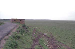
This area solely comprises unenclosed, developing salt marsh lying just above average High Water Mark and crossed by meandering streams and pills. The embankment of the South Wales main railway line, opened in 1852 (Ludlow 1999, 28), forms the northern edge of the area.
The only recorded archaeological features are the quays described above, sea-defences and two wrecks.
There are no buildings.
This is a distinctive landscape area mainly lying between High Water Mark and the sand hills of Pembrey Burrows to the south and Kidwelly Burrows to the north .