Home > Historic Landscape Characterisation > Carmarthen Bay Estuary Area > |

 ALLT HILLTOP
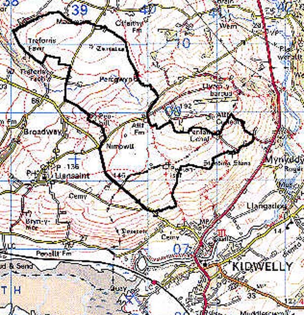

GRID REFERENCE: SN 397090
AREA IN HECTARES: 344.80
Historic Background
An area that was held as a foreignry of the Medieval Lordship of Kidwelly, which in 1106 was granted by King Henry I to Bishop Roger of Salisbury (Avent 1991, 167). It passed between Anglo-Norman and Welsh hands during the 12th- and early 13th-century until the more settled conditions of the later 13th- and 14th-century under the tenure of the Chaworths and, from 1327, the Duchy of Lancaster. The pattern of large, regular fields suggests that it may represent fairly late enclosure, and part of it at least it may have lain within Allt Cunedda common which was described in 1609 as 'free and common of pasture for all manner of cattle' (Rees 1953, 208-9). The field name Park-y-lan suggests that a section of the northern part of the area may in contrast have been ecclesiastical land. Enclosure of the common begun in c.1575 when Edward Downley and Henry Vaughan of Kidwelly enclosed 'two closes' occupying seven acres of the common 'and converted the same to their own use' (ibid.). The farms Penlan-uchaf and Penlan-isaf are derived from a larger holding which may represent such an initial stage of enclosure. The process of enclosure was drawn out, however, and the core of the common, lying to the east of this area, was still unenclosed in 1841 (St Ishmael tithe map). Around its margin were several farms including Allt and Penlan-uchaf, but these do not appear to have developed from squatter settlements. In 1630 the Lordship of Kidwelly was sold to the Carbery earls who held it until 1804 when it passed to the Cawdor estate (Jones 1983, 18). There has been no subsequent development in the area.
Base map reproduced from the OS map with the permission
of Ordnance Survey on behalf of The Controller of Her Majesty's Stationery
Office, © Crown Copyright 2001.
All rights reserved. Unauthorised reproduction infringes Crown Copyright
and may lead to prosecution or civil proceedings. Licence Number: GD272221
 Description and essential historic landscape components
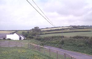
An area occupying the southern flank of Allt Cunedda, between 100 and 160 m. It is distinguished by a pattern of large, fairly regular enclosures, with earth banks supporting well-maintained hedges, probably established during the 16th- and 17th-century. Land-use is nearly all improved pasture and there is no woodland. Farms are scattered but there is a significant cluster around the former Allt-Cunedda common to the north-east.
Archaeological features include a Bronze Age round barrow and cist to the south, and possible round barrows and standing stones are suggested by field names to the north. A large Iron Age hillfort beyond the northern edge of the area gives the hill its name.
The farms generally appear to be 18th- or 19th-century, stone-built and slate roofed, of two storeys and three bays, and in the vernacular tradition. 19th century stone outbuildings are present on most farms and arranged informally. Farms have extensive modern outbuildings.
This is a well-defined historic landscape area, distinct from the smaller, narrower enclosures of the area to the south, east and west, and the irregular enclosures of the area to the north.