Home > Historic Landscape Characterisation > Carmarthen Bay Estuary Area > |

 WAUN BAGLAM
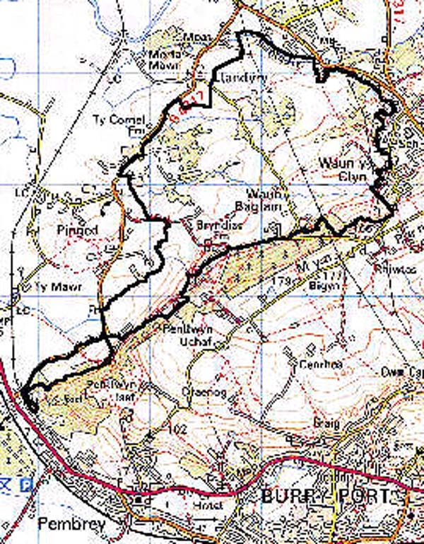
GRID REFERENCE: SN 435037
AREA IN HECTARES: 359.40
Historic Background
Formerly part of the Medieval Manor of Pembrey this is an area of rectilinear enclosures derived from former strip fields. Some are shown as field strips on the Pembrey tithe map of 1841, but the process of enclosure was more advanced than in other areas. It may have begun in the 17th century, prior to the reclamation of Pinged Marsh which was undertaken from the 18th century onwards. Cilrehedyn may be the site of a Medieval settlement and Berth Farm may be the tenement 'Tir y Bearth' which was in the freehold possession of Thomas Jenkin John ap John, from the Lordship of Kidwelly, in 1609 (Rees 1953, 204). Place-name evidence suggests the management of at least part of the area as a Post-Medieval plantation. During the early 18th-century coal production spread into the area from its nucleus of early pits around Trimsaran and Moat, and pits were recorded at Waun Baglam itself (Ludlow 1999, 24). There has been little 20th century housing development but a later 20th-century poultry farm now occupies a substantial part of the area.
Base map reproduced from the OS map with the permission
of Ordnance Survey on behalf of The Controller of Her Majesty's Stationery
Office, © Crown Copyright 2001.
All rights reserved. Unauthorised reproduction infringes Crown Copyright
and may lead to prosecution or civil proceedings. Licence Number: GD272221
 Description and essential historic landscape components
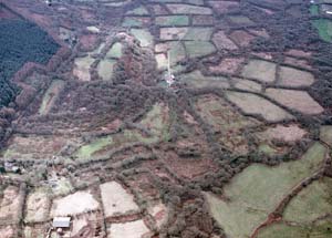
The area comprises irregular, medium-sized rectilinear enclosures occupying a general downhill trend to the north-west, from 120 m to 20 m, representing former strip fields enclosed from the 17th to the early 19th-century. Boundaries are earth banks with hedges, generally overgrown and enclosing mostly unimproved pasture. There are substantial pockets of deciduous woodland particularly around Wern and Berth farms, and some neglected hedges have distinctive trees giving the landscape a wooded appearance; such woodland, however, is probably all secondary. Settlement is characterised by dispersed farms whose buildings appear to belong mainly to the 19th- and 20th-century, but Berth Farm may have 17th century origins (Rees 1953, 204), and the morphology of Waun Baglam/Tyllwyd and Bryn-dias suggest that they may have developed as squatter settlements on the edge of Waun Baglan Common (Area 176) in the 18th- and early 19th-century.
Recorded archaeology includes a Bronze Age standing stone to the south-west of the area, a possible Bronze Age round barrow and an Iron Age defended settlement. There is physical evidence for coal-pits and mines from the early 18th-century onwards.
Buildings within this area mostly comprise farmsteads which are generally late 19th- and 20th-century in date, and stone-built with slate roofs, a scatter of 19th century cottages and other houses, and a little late 20th-century dispersed residential development. Farmhouses are small, two-storey and three-bay, in the vernacular tradition and old farm buildings where present are small, often of just one range and stone- or brick-built. Cottages are stone built.
This is a fairly distinct historic landscape area which contrasts with the hillslope of Mynydd Penbre and Parliamentary Enclosure to the south and east. The boundary with the area to the north and west is less well-defined, but the outlines of the former field strips are better-preserved than in that area.