|

248 DYFFRYN FANAGOED 
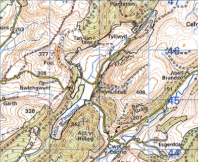
GRID REFERENCE: SN 688454
AREA IN HECTARES: 127.20
Historic Background
An area occupying the upland valley floor of the Afon Fanagoed, a tributary
of the Afon Cothi, where it emerges from the Cambrian Mountains. It once
lay within Cwmwd Caeo, specifically Maenor rhwng Twrch a Chothi, of Cantref
Mawr which remained an independent Welsh lordship until 1284 and largely
retained native systems of tenure throughout the Medieval period. The
area lies in a high valley but is a relatively fertile pocket of land
which has probably always been subject to fairly intensive land-use. It
is occupied by a system of small, rectangular fields, some of which exhibit
physical evidence of ridge-and-furrow which here may have been a response
to waterlogged soil conditions and not necessarily of Medieval date; the
boundaries were in place by 1840 (Cynwyl Gaeo tithe map). There are now
a number of small farmsteads.
Base map reproduced from the OS map with the permission
of Ordnance Survey on behalf of The Controller of Her Majesty's Stationery
Office, © Crown Copyright 2001.
All rights reserved. Unauthorised reproduction infringes Crown Copyright
and may lead to prosecution or civil proceedings. Licence Number: GD272221
Description and essential historic landscape components
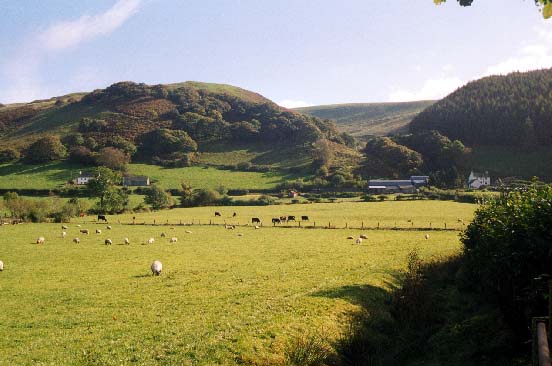
This area lies in a high valley - the upper valley of the Afon Fanagoed
- between 200 m and 250 m. It is a landscape of dispersed farms and fields.
Fields are small and irregular, and are bounded by earth banks topped
by hedges. Apart from alongside lanes and tracks, hedges are in poor condition;
either derelict or reduced to straggling lines of overgrown bushes and
small trees. Farmland land-use mostly comprises improved pasture, but
there is peaty and rushy ground across much of the valley floor, and bracken
on steep slopes. There are a few small stands of scrubby deciduous woodland.
Transport links are local lanes and tracks. The few farmsteads are located
on the lower valley sides, or at the foot of the valley sides. Farmhouses
are late 18th- or 19th-century in date, stone-built, two-storey and three-bay,
and in the vernacular tradition. Stone outbuildings are of a similar date
and relatively modest in size, usually consisting of one or two ranges.
Farms have small modern agricultural buildings associated with them. There
is no recent residential development.
Recorded archaeology is confined to the ridge-and-furrow, and a mill site.
Buildings are not particularly distinctive and none are listed.
This is a very well defined area as it is bounded either by high, semi-open moorland or forestry plantations.