Burry Holms
(Photo © RCAHMW Crown Copyright)
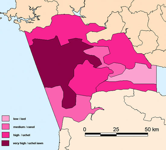
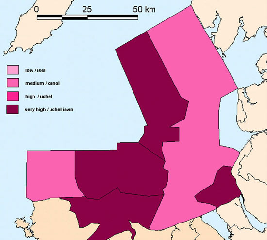
Management Areas The areas shown on these maps have been defined from combining landscape character areas and potential for survival of deposits areas. A significance score for each management area has been calculated by combining the value assigned to the landscape character areas and the value assigned to the potential for survival areas. The significance scores are graded from low to high and are designed to provide a quick reference to the potential importance of any one area with, for example, a low score having medium archaeological/historic landscape potential and low potential for survival, and a very high score having high archaeological/historic landscape potential and high potential for survival. Significance scores are an approximation; as for most areas more data is required. To aid planners and others concerned with managing the marine environment broad-brush guidance is provided for each management area. As with some previous maps, the boundary between management areas should be regarding as a broad zone of change, which might be refined in the future. Note: These management areas have been designed primarily for the use of decision makers in Wales, but the general principles they represent may well be appropriate for equivalent English users. Click on an area on the maps to bring up a text box with further information on that area. Click on the cross in the top right hand corner to get rid of the box.
|
 |
 |
 |
 |
 |
 |
|