Home > Historic Landscape Characterisation > Upland Ceredigion > |

 YSGUBORNEWYDD
GRID REFERENCE: SN 667814
AREA IN HECTARES: 234.4
Historic Background
The history of this area has not been researched. There are no surviving estate maps to provide information on the evolution of the landscape. The earliest surveys - the tithe maps of the 1840s - show a landscape similar to that of today, with medium- to large-sized fairly regular-shaped fields. It is assumed that this field pattern developed in the 18th century, and that prior to this the area comprised unenclosed sheep-walk or moorland. If this is correct, then the land is likely to have been claimed by the Crown, and was perhaps enclosed illegally by individual farmers or estates. There are no inhabited settlements. The landscape has not changed substantially over the past 150 years.
Description and essential historic landscape components
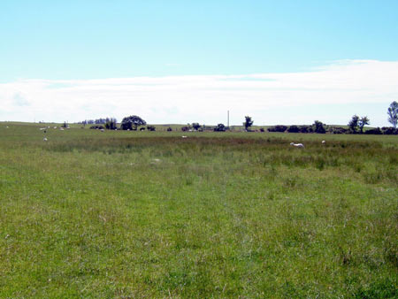
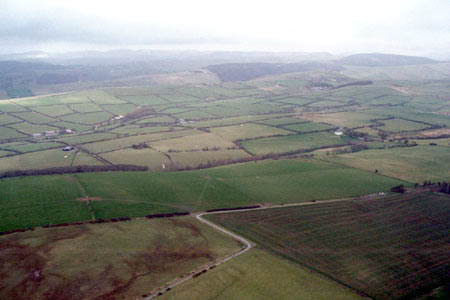
This area consists of rounded, undulating ridges and hills lying at between 150m and 210m. Improved grazing dominates, though there are hollows of rougher, rushy ground, and some small coniferous plantations have been established. There are no inhabited settlements. The whole area has been divided into a field system of medium- to large-sized fairly regular-shaped enclosures. Boundaries to the fields comprise earth banks topped with hedges. Hedges are in fair to poor condition, with many overgrown or derelict. Wire fences supplement all bank and hedge boundaries.
There is little recorded archaeology in this area, however, what there is does provide a time-depth element to the landscape. An Iron Age fort - Capel Bangor Camp - is a major site. There is also a Bronze Age round barrow and a post-Medieval mill site.
This area is defined to the north and south by lower
lying settled and more anciently enclosed land. To the east is higher,
formerly unenclosed land, and to the southeast woodland.
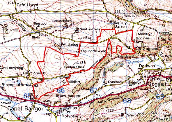
Base map reproduced from the OS map with the permission
of Ordnance Survey on behalf of The Controller of Her Majesty's Stationery
Office, © Crown Copyright 2001.
All rights reserved. Unauthorised reproduction infringes Crown Copyright
and may lead to prosecution or civil proceedings. Licence Number: GD272221