Home > Historic Landscape Characterisation > Upland Ceredigion > |

 PERAIDD FYNYDD
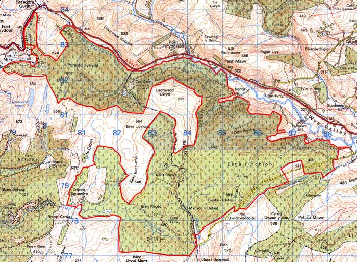
GRID REFERENCE: SN 876803
AREA IN HECTARES: 2366
Historic Background
This large block of upland forestry straddles the border between Ceredigion and Powys, with most of the area lying within Powys. On the Ceredigion side of the border this area lay within Gwestfa Dyffryn Rheidol in Cwmwd Perfedd. In more recent times, as it was unenclosed, it was probably considered Crown land. In the 1950s and 1960s this area was acquired by the Forestry Commission and planted with conifers.
Description and essential historic landscape components
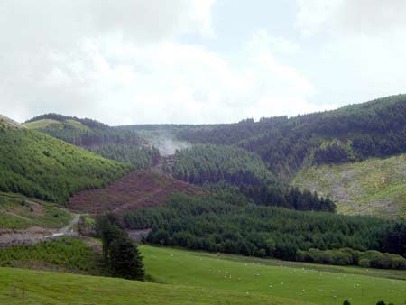
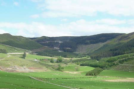
An area of high, craggy upland ranging in height from about 300m on its eastern fringes to over 500m at its highest point. It is now entirely covered with hard-edged forestry plantations. Prior to afforestation all the land on the Ceredigion side of the county boundary comprised unenclosed moorland. That on the Powys side consisted of unenclosed land at higher levels, but may have included some former enclosed land at lower levels, though this section of the area has not been examined in detail. Plantations, tracks, roads and other forestry features are the most common and prominent historic landscape components.
A small roman fort - Cae Gaer - lies in deep forestry on the Powys side of the county boundary. Other recorded archaeology mostly comprises remains of the metal mining industry, although deserted settlements and cottages indicate that this upland was at least sparsely populated until the 19th century. Several Bronze Age round barrows lend a time-depth element to the landscape.
The hard edge of the forestry defines this area. On almost every side lies unenclosed moorland.
Base map reproduced from the OS map with the permission
of Ordnance Survey on behalf of The Controller of Her Majesty's Stationery
Office, © Crown Copyright 2001.
All rights reserved. Unauthorised reproduction infringes Crown Copyright
and may lead to prosecution or civil proceedings. Licence Number: GD272221