Base maps reproduced from the OS map with the
permission of Ordnance Survey on behalf of The Controller of Her Majesty's
Stationery Office, © Crown Copyright 2001. All rights reserved. Unauthorised
reproduction infringes Crown Copyright and may ead to prosecution or civil
proceedings. Licence Number: GD272221
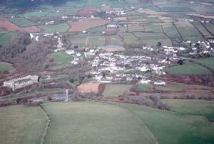
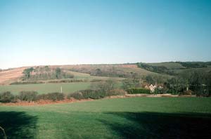
The medieval
castle located on one valley side and the medieval church on the
opposite side dominate Manorbier historic landscape
character area. Modern housing is interspersed with the mainly 19th
century stone-built houses and other buildings that form the small
village core. Included in this area are small mid 20th century housing
estates. |
|
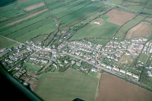
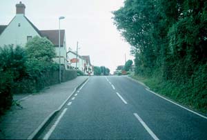
Jameston
is a nucleated hamlet consisting of a core of 19th century stone-built
houses and modern dwellings, with substantial 18th century farmhouses
and farm buildings on its fringe. It was formerly an agricultural
village, but most of the farm buildings have been converted to residential
use. |
|
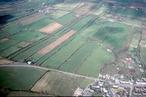
Long
narrow fields enclosed by high stone-faced banks with hedges, mortared
stonewalls and dry-stone walls strongly characterise the Manorbier
Newton Strip Fields historic landscape character area.
Dispersed farms and other buildings are mainly 19th century and
stone-built. |
|
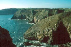
Freshwater
East to Lydstep Coastal Strip consists of high sea cliffs,
sandy coves and a narrow band of cliff top through which runs the
Pembrokeshire Coast Path. The built heritage includes a neolithic
chambered tomb, iron age forts, World War 2 military installations
and old stone quarries. |
|
East
Moor and West Moor is a windswept agricultural historic
landscape character area of large fields and dispersed farms. Boundaries
are either mortared stonewalls or banks topped with low hedges.
There are few trees. |
|
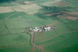
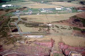
Late
20th century military buildings and installations and an iron age
fort, all set in pasture characterise Manorbier Camp
historic landscape character area. |
|
Lydstep
historic landscape character area is a hamlet. Nineteenth
century, early 20th century and modern buildings flank the small
ruins of Lydstep Palace in the centre of the village. The use of
red roofing tile (probably the influenced by the Lydstep estate)
and rough-dressed limestone are a feature of the village. |
|
Large regular
fields bounded by banks and hedges or mortared walls, and substantial
farms characterise the Norchard – Tarr historic
landscape character area. Farmhouses with either medieval components
to them or ruined medieval houses close to them are a feature of
this area. |
|
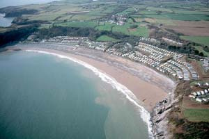
Lydstep
Haven historic landscape character area is dominated by
a modern caravan park, with a strong secondary country estate component
consisting of Lydstep House, lodges and woodland. |
|
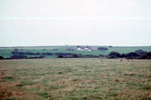
Substantial,
dispersed farms and regularly shaped fields bounded by windswept
banks and walls characterise Hill Farm – Baldwin’s
Moor historic landscape character area. Most buildings
date to the late 18th century or early 19th century. Limestone is
the traditional building material. |
|