Base maps reproduced from the OS map with the permission
of Ordnance Survey on behalf of The Controller of Her Majesty's Stationery
Office, © Crown Copyright 2001. All rights reserved. Unauthorised reproduction
infringes Crown Copyright and may ead to prosecution or civil proceedings.
Licence Number: GD272221
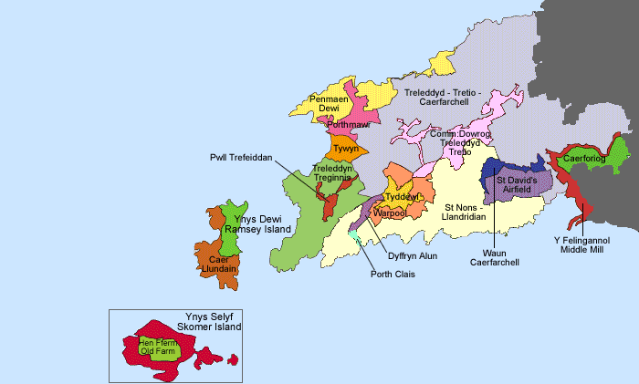
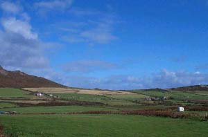
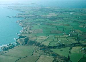
285 Penmaen Dewi historic landscape
character area occupies the extreme western point of the St David's
peninsula. It comprises high sea cliffs backed by open moorland
to the summit of Carn Llidi at 180m. Prehistoric remains, including
a promontory fort, chambered tombs and field systems lie on the
moorland. |
|
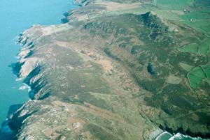
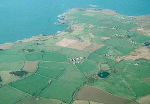
| 286 Porthmawr historic
landscape character area is a treeless landscape of dispersed farms
and fields. Dry-stone walls are the main type of field boundary.
Hedges are few, and where present are low and windswept. Improved
pasture is the main land-use. Camp sites and caravan parks are present.
Paired farms situated on the south-facing slopes of Carn Llidi are
a feature of this landscape. A wide range of dwelling type is present.
Stone is the traditional building material. |
|
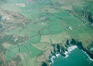
| 287 Tywyn historic landscape
character area comprises an area of wind-blown sand inland of Whitesands
Bay. It was common land until enclosed by an Act of Parliament in
1869. Inland of a dune system close to the coast, the blown-sand
is covered with grass. A golf course, hotel, modern houses, car
park and other tourist facilities are situated in this area. |
|
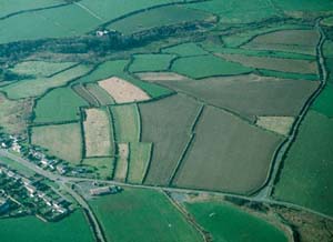
| 288 Treleddyd - Tretio - Caerfarchell
historic landscape character area lies on rich farmland on the northern
side of the St David's peninsula. It consists of fields, compact
hamlets and dispersed farms. Dwellings are traditionally stone-built
and range in date and style from sub-medieval houses and Georgian
houses to 19th century cottages. Large, modern agricultural buildings
are a strong element of the landscape. Field boundary banks are
topped with low, windswept hedges. Camp sites and caravan parks
are present, but land-use is predominantly improved pasture with
some arable. It is a treeless landscape. |
|
| 289 Treleddyn - Treginnis
historic landscape character area lies on the western fringes of
the St David's peninsula. It comprises high sea cliffs and an agricultural
landscape of small fields, tor-like rocky outcrops and scattered
farms. Farms are clustered in groups which shelter in the lee of
the tors. Buildings are traditionally stone-built and range from
sub-medieval houses and Georgian houses to 19th century cottages.
Land-use is a mixture of pasture, arable and rough grazing. It is
a treeless landscape. Camp sites and caravan parks are present.
|
|
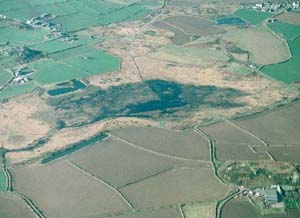
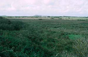
290 Pwll Trefeiddan
historic landscape character area consists of unenclosed wet common
with tracts of standing water. |
|
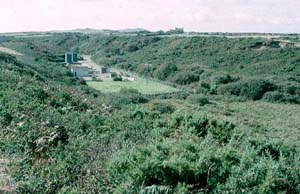
291 Dyffryn Alun
historic landscape character area consists of a narrow, scrub covered,
steep-sided valley. The valley bottom is pasture or marsh. Hedges
on the boundary banks in the valley bottom are neglected and redundant.
A sewage works is located here. |
|
292 St Nons - Llandrudion
historic landscape character area lies along the southern fringe
of the St David's peninsula. It includes high sea cliffs, inland
of which lies a landscape of small fields and dispersed farms. Traditionally,
buildings are stone-built, with most houses dating to the 19th century.
There are several camp sites and caravan parks in the area, but
the predominant land-use is pasture with some arable land. Hedges,
where they survive on the earth and stone boundary banks, are low
and windswept. It is a treeless landscape. |
|
| 293
Comin: Dowrog - Treleddyd - Tretio historic landscape character
area consists of wet and marshy common land. |
|
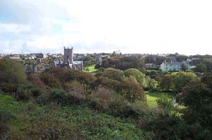
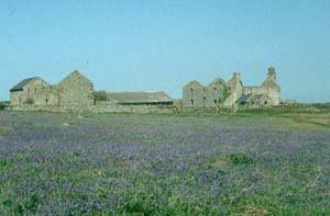
294 Tyddewi historic
landscape character area consists of the city of St David's. It
includes the cathedral close - St David's Cathedral, the old Bishop's
Palace and associated buildings - the core of the medieval city
and modern development on the outskirts. Buildings are traditionally
stone-built. Outside the cathedral close, there is a large variety
in building types, but most buildings date to the 19th- and 20th-century.
|
|
295 Warpool historic
landscape character lies across the former open fields surrounding
St David's City. Narrow strip-fields enclosed by banks and low hedges
characterise this area. These strips have been encroached on by
19th- and 20th-century development on the edge of the city. |
|
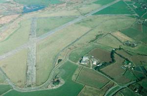
296 St David's airfield
historic landscape character area consists of an open landscape
of restored pasture. No buildings of the second world war airfield
remain, but short sections of concrete runway and service roads
survive. |
|
297 Waun
Caerfarchell historic landscape character area comprises wet and
marshy common land. |
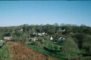
|
298 Middle Mill
historic landscape character area lies in the narrow, steep-sided
valley of the Solva River and is centred on a hamlet - Middle Mill.
Traditional building material is stone, with most dwellings dating
to the 19th century, but with a scattering of 20th century houses.
A large abandoned quarry lies on the valley side above the hamlet.
Land-use consists of pasture on the valley bottom and woodland and
scrub on the valley sides. |
|
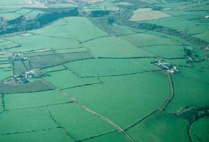
299 Caerforiog
historic landscape character area consists of large, regular
fields of improved pasture and arable divided by banks and hedges,
and dispersed farms. Hedges are low and windswept and it is a treeless
landscape. Farms are large |
|
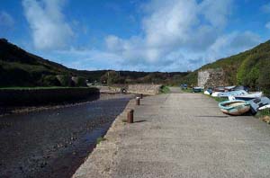
300 Porth Clais
historic landscape character area includes a small stone-built harbour,
quays, limekilns and car parks located in a narrow, steep-sided
inlet. |
|
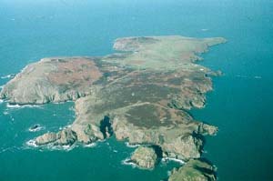
301 Caer Llundain
- Caer Ysgubor historic landscape character area comprises
the hilly and craggy open moorland part of Ramsey Island, bounded
on three sides by high sea cliffs. Remains of prehistoric field
boundaries are found in this area. It is treeless landscape. |
|
302 Ramsey
historic landscape character area is the sheltered, northeast part
of Ramsey Island which has been divided into large fields by dry-stone
walls. It includes a19th century farm and a landing place. The land
is mostly under pasture. It is a treeless landscape. |
|
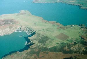
303 Ynys Selyf
- Old Farm historic landscape character area lies in the centre
of Skomer Island and consists of that part of the island farmed
in the 18th- and 19th-century. The land is not now farmed, but the
walls and banks of the fields and the old farmstead survive. |
|
304 Ynys Selyf
- prehistoric fields historic landscape character area comprises
all of Skomer Island not cultivated in the 18th- and 19th-century.
High sea cliffs surround a plateau on which the remains of prehistoric
fields and settlements survive as low earthworks and walls. It is
treeless landscape. Heavy grazing by rabbits maintains short grass
over much of the island. |
|