Home > Historic Landscape Characterisation > Carmarthen Bay Estuary Area > |

 MYNYDD PENBRE ENCLOSURE

GRID REFERENCE: SN 448034
AREA IN HECTARES: 216.50
Historic Background
An area of former common on Mynydd Penbre. Mynydd Penbre represented the greater part of Maenor Penrhyn during the Medieval Period which, with the manor of Pembrey, was initially held of the Lordship of Kidwelly as both a Welshry and a foreignry (Rees 1953, 200). It enjoyed manorial status at least as early as 1361 and had, by 1630, become independent of Kidwelly Lordship (Jones 1983, 18). Physical evidence for ridge and furrow cultivation has been recorded at Cwm-y-Rhyfel to the east of the area, but most it was unenclosed common land, which Rees called 'Mynydd Rhos' (Rees, 1932). It remained so from the Medieval period until the mid-19th century when it was enclosed - privately, as no Act of Parliament survives. Much of the common may have been wooded during the Medieval period (Williams 1981, 5). Waun Baglam/Tyllwyd and Bryn-dias, in a neighbouring area, may have developed as squatter settlements on the edge of the common in the 18th- and early 19th-century, and the peripheral development around Heol-ddu just beyond the west end of the area may have similar origins but is probably later, associated with a nearby quarry. The 20th century has seen the construction of a number of scattered, single dwellings.
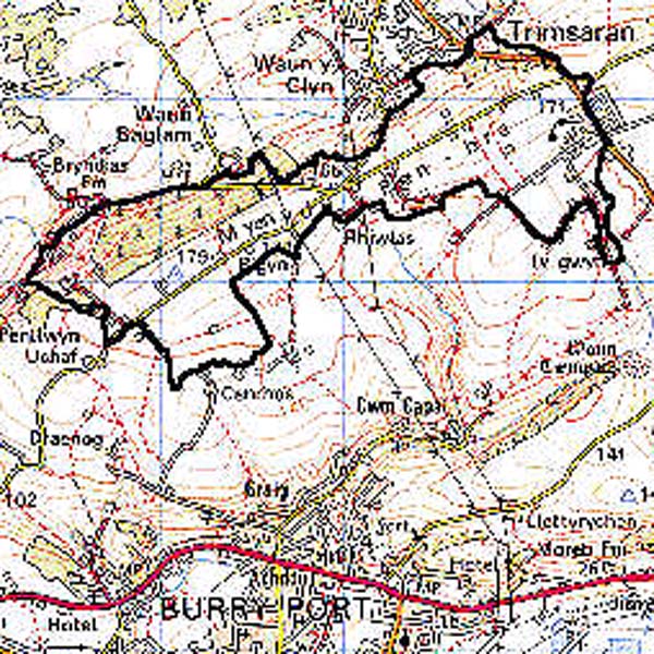
Base map reproduced from the OS map with the permission
of Ordnance Survey on behalf of The Controller of Her Majesty's Stationery
Office, © Crown Copyright 2001.
All rights reserved. Unauthorised reproduction infringes Crown Copyright
and may lead to prosecution or civil proceedings. Licence Number: GD272221
 Description and essential historic landscape components
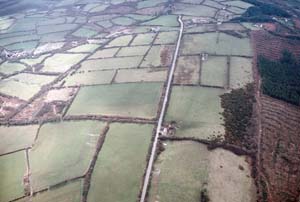
An area of regular, rectilinear enclosures, probably 19th century, with straight roads and tracks, occupying former common land on top of Mynydd Penbre at an average height of 165 m. The boundaries, roads and tracks belong to the mid 19th-century, the former being earth banks with hedges that are mostly unmanaged, overgrown and becoming derelict, and supplemented by wire fencing. Land-use is pasture, both improved and unimproved. There is no deciduous woodland, but a large area to the west, Waun Baglan Wood, was planted with coniferous forest in the later 20th century. The dispersed farmsteads and housing are mainly 19th- and 20th-century, but it has been suggested that Bigyn may have Medieval origins.
Recorded archaeology is limited and includes a possible Bronze Age round barrow, a possible Iron Age hillfort and a quarry. In their present form the buildings are not distinctive, are of 19th- and 20th-century date and are in a variety of materials.
Farmhouses and other dwellings are either late 19th century, stone-built, two-storey or one-and-a-half storey and three-bay, relatively small and in the vernacular tradition, or modern. Farm outbuildings are not common, and where they exist are small, generally one range, and late 19th- or 20th-century.
A well-defined historic landscape area distinct from the pattern of smaller, irregular enclosures to the northwest and the largely unenclosed woodland to the southwest.